We turn authoritative environmental event data into clear, checked map and data packages for journalists and newsrooms.
Our coverage includes Environment Agency flood warnings in England and satellite analyses of candidate flooded areas and landslides around the world.
Reviewed before publication
Only an editor-approved revision appears in this public list. A source change creates a new draft; it never replaces an approved release without review.
Satellite-detected surface water · Revision 1 · Published
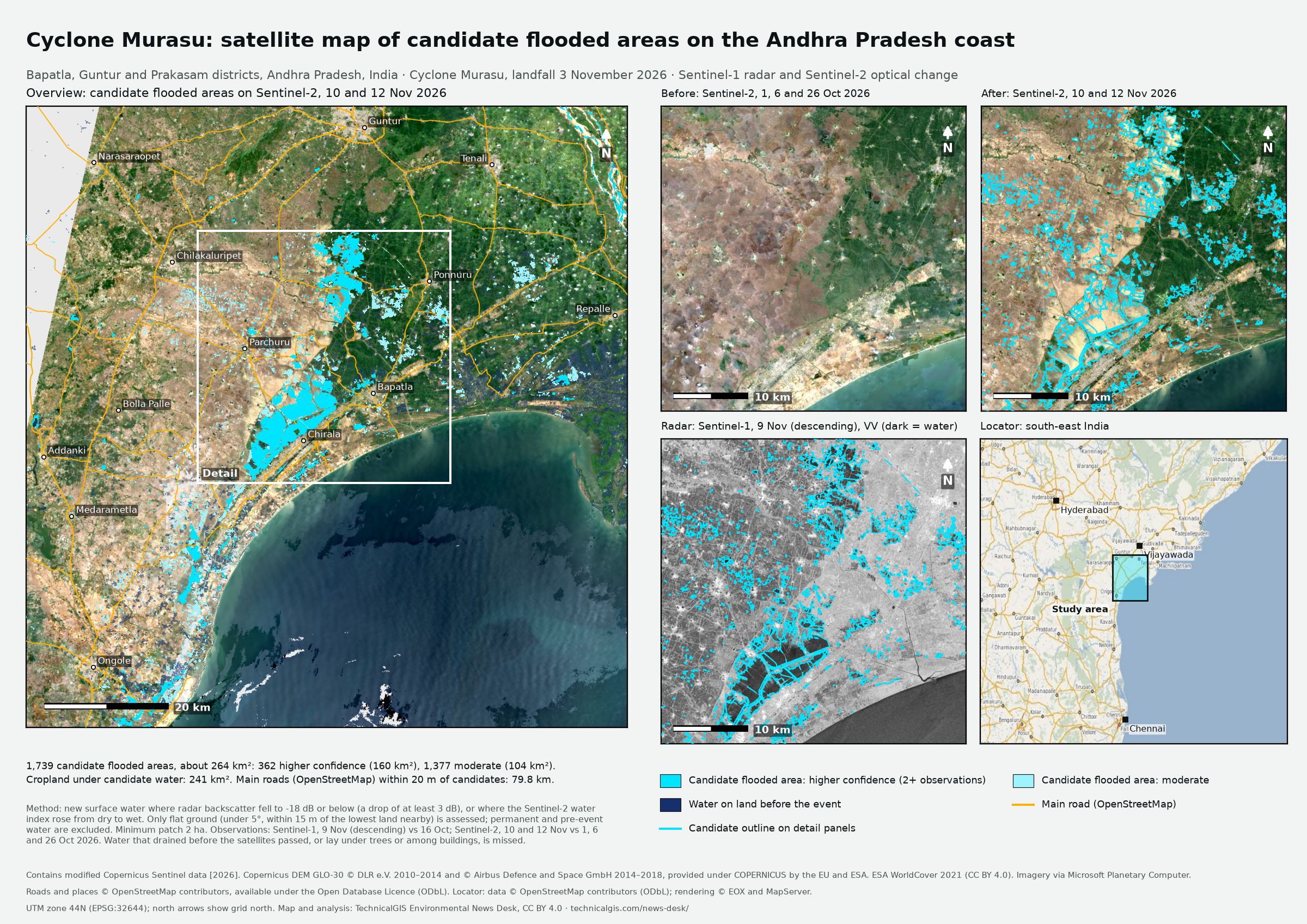
Sentinel radar and optical images show about 264 km² of new surface water on the Andhra Pradesh coast after Cyclone Murasu. The analysis compares pre-event imagery with observations taken after the storm.
Satellite-detected surface water · Revision 1 · Published
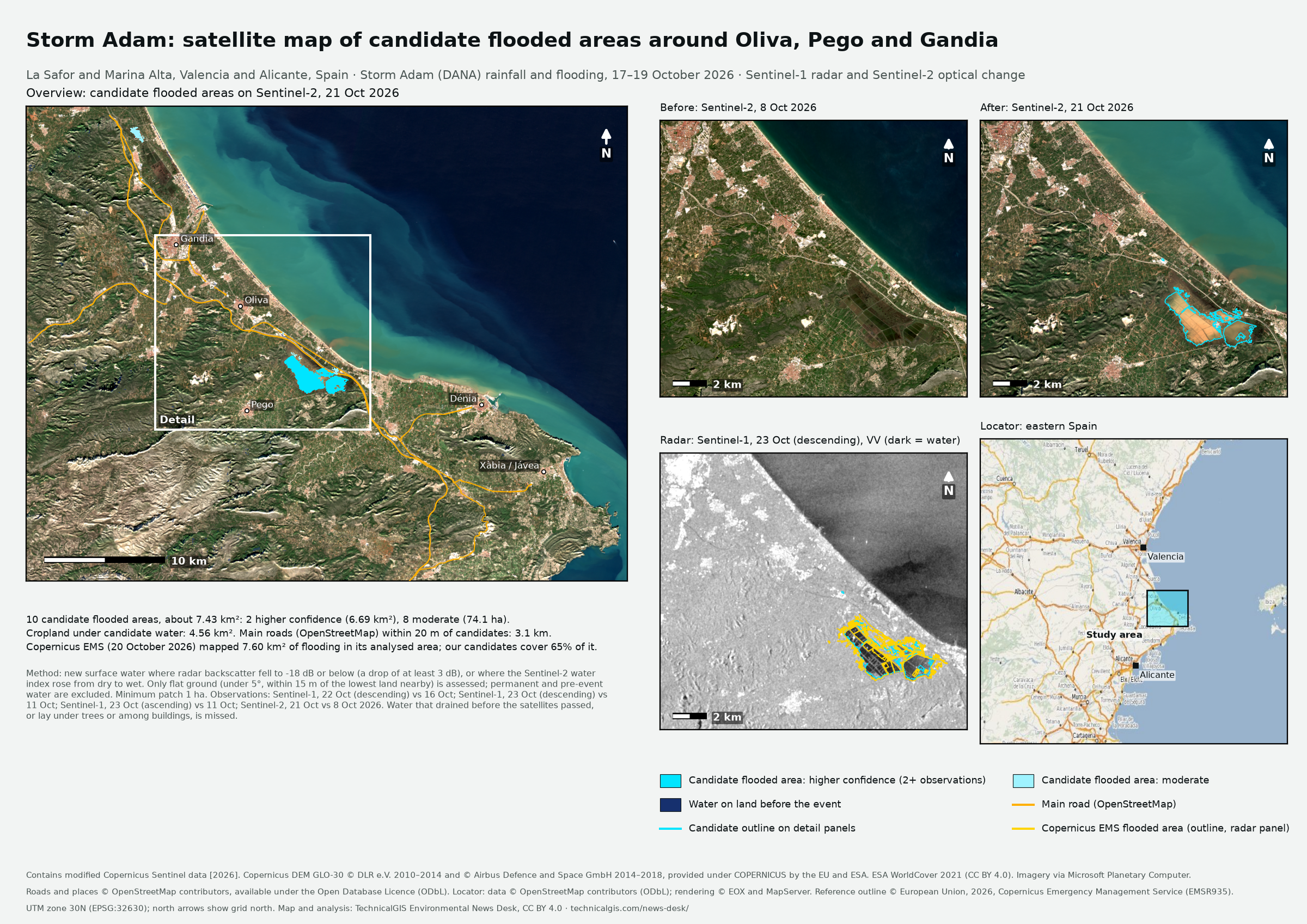
Sentinel radar and optical images show about 743 hectares of new surface water around Oliva, Pego and Gandia after Storm Adam. The analysis compares pre-event imagery with observations taken after the storm.
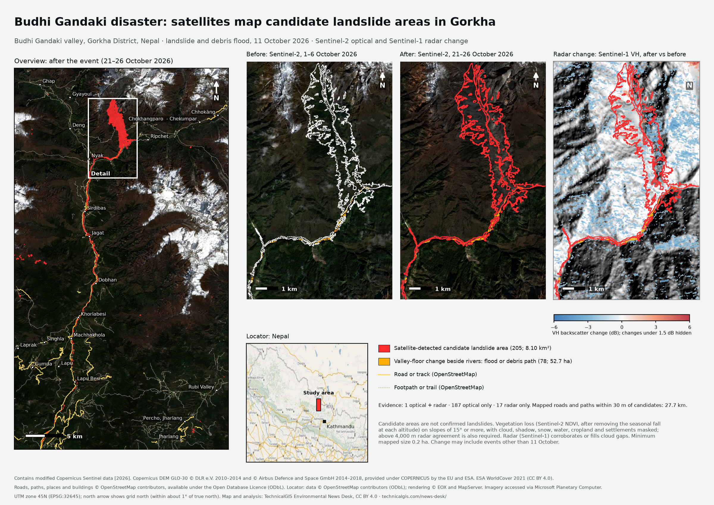
Sentinel radar and optical images show about 810 hectares of hillside change in Budhi Gandaki valley, Gorkha District, Nepal. The analysis compares imagery from before and after the disaster.
The first live source is the Environment Agency flood-monitoring API. It does not provide complete coverage of the UK.
Live warning monitoring covers England only. Feeds for Wales, Scotland and Northern Ireland are not connected.
Satellite packages, such as the Nepal landslide analysis, are separately reviewed analyses, not continuous monitoring feeds.
What the first flood packages show
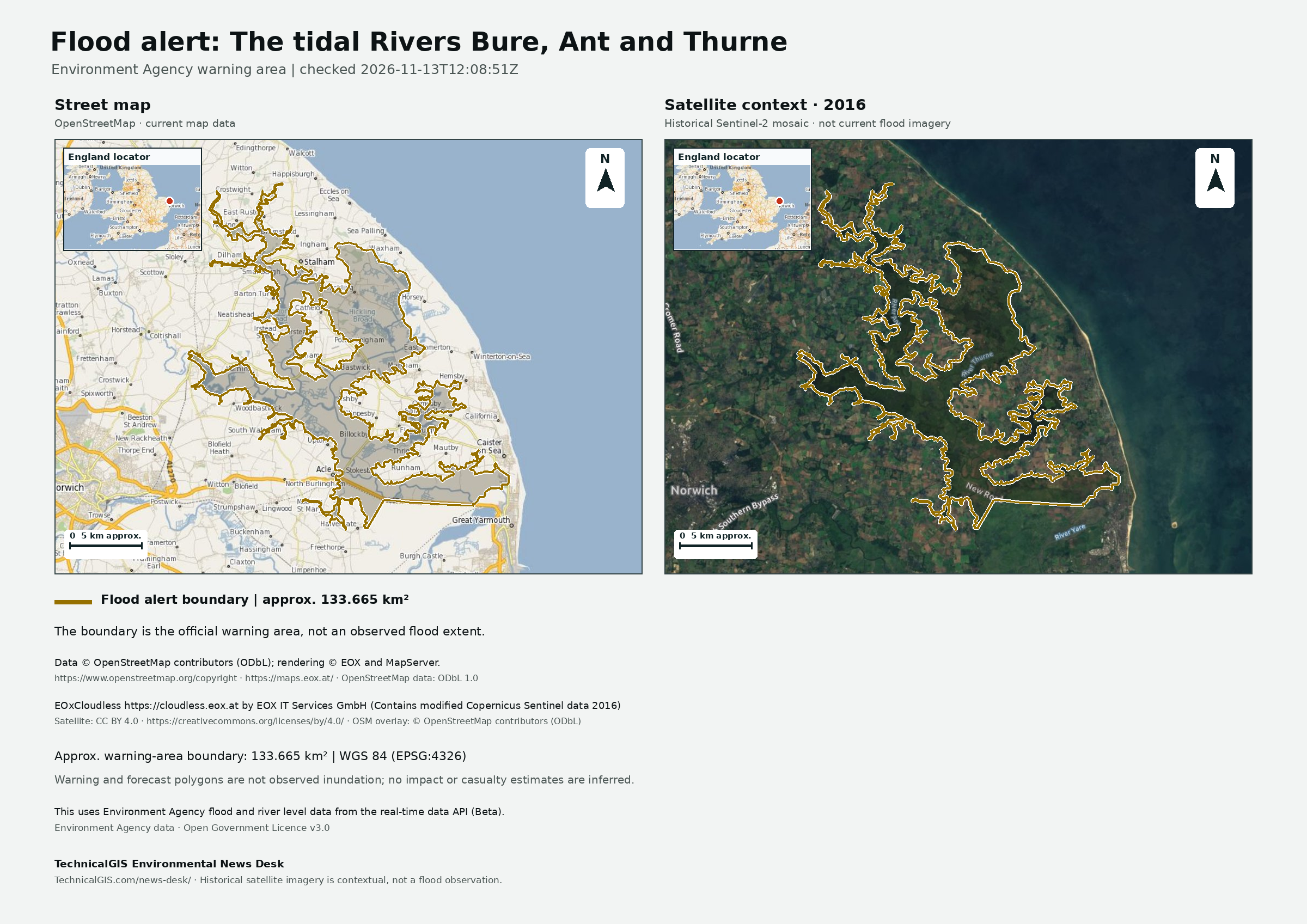
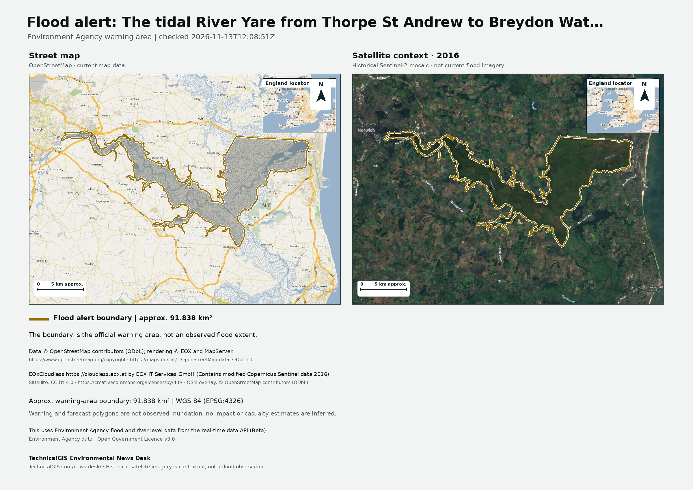
The map shows the Environment Agency's official flood-warning area. It is not a map of observed floodwater.
Its approximate area describes that boundary, not the area flooded. The first release does not estimate
casualties, displacement, damage or people affected.
Satellite change analysis identifies candidate landslide areas and detected surface water, not confirmed landslides or a confirmed flood extent. Each event briefing
describes the imagery dates, method, confidence and sources used. It must not be read as a confirmed damage assessment.
Each approved package includes the source warning, its update time and licence, a geospatial GeoJSON, CSV,
editable vector map (SVG), print PDF, PNG, a short factual briefing and a ZIP containing the files and provenance.
The source credit is carried into the map and package.
Environment Agency data are supplied under the Open Government Licence v3.0.
Attribution: “This uses Environment Agency flood and river level data from the real-time data API (Beta).”