Maps, source-led environmental briefings and GIS data for journalists: downloads, licences, attribution, methods and corrections.
Last updated
Maps and data for your newsroom
The Environmental News Desk turns environmental source data into checked maps, short factual briefings and downloadable GIS packages. Journalists can read the story, inspect the source dates and methods, and download the files without an account. Only editor-approved revisions are public.
Each package includes a PNG for web use, a print PDF, an editable SVG, GeoJSON, CSV, a briefing and a manifest recording sources and reuse terms. The ZIP collects these files in one place. Stable event URLs keep the latest approved revision and link to earlier approved versions, so a newsroom can cite exactly what it used.
Read the map before writing the headline
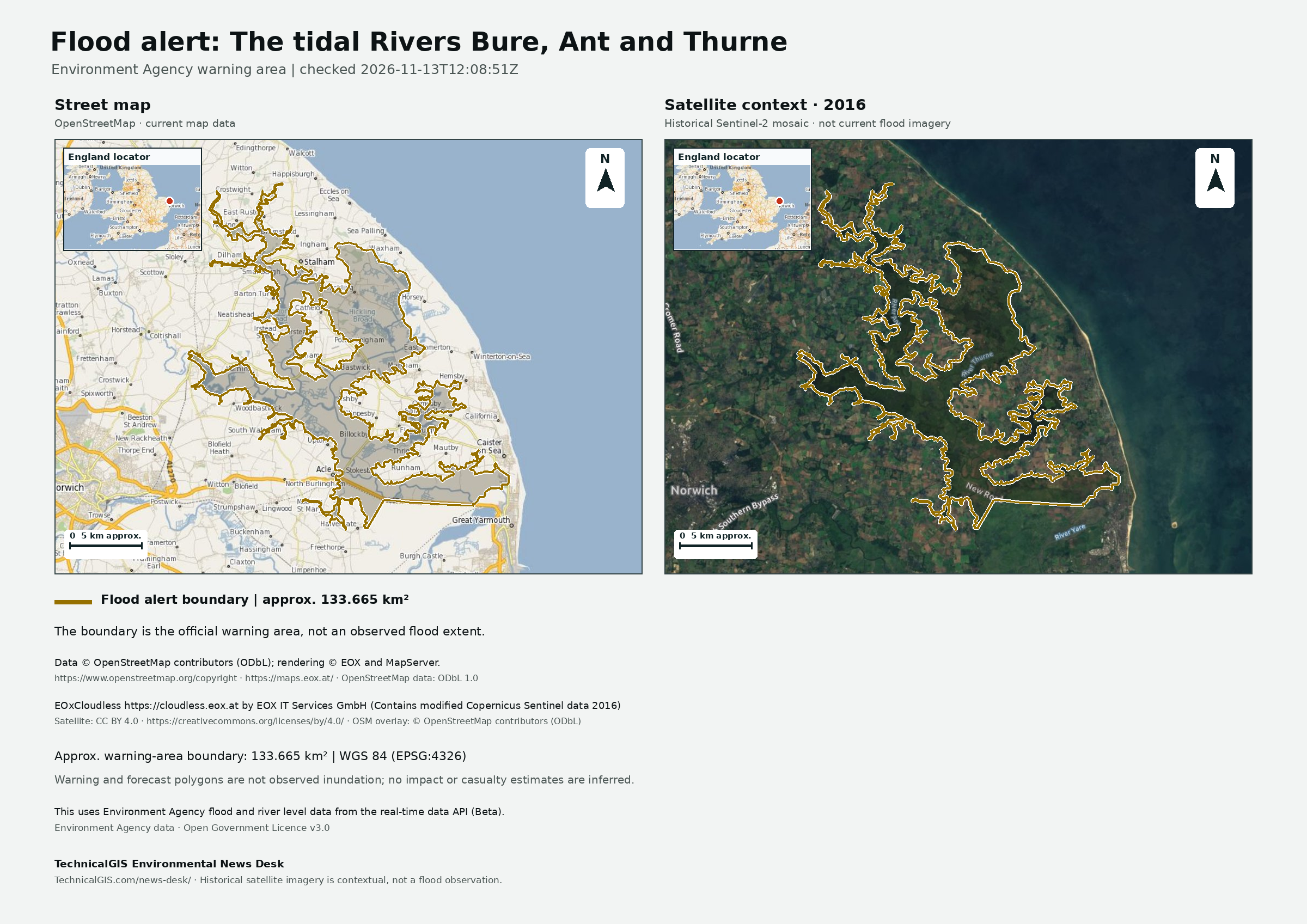
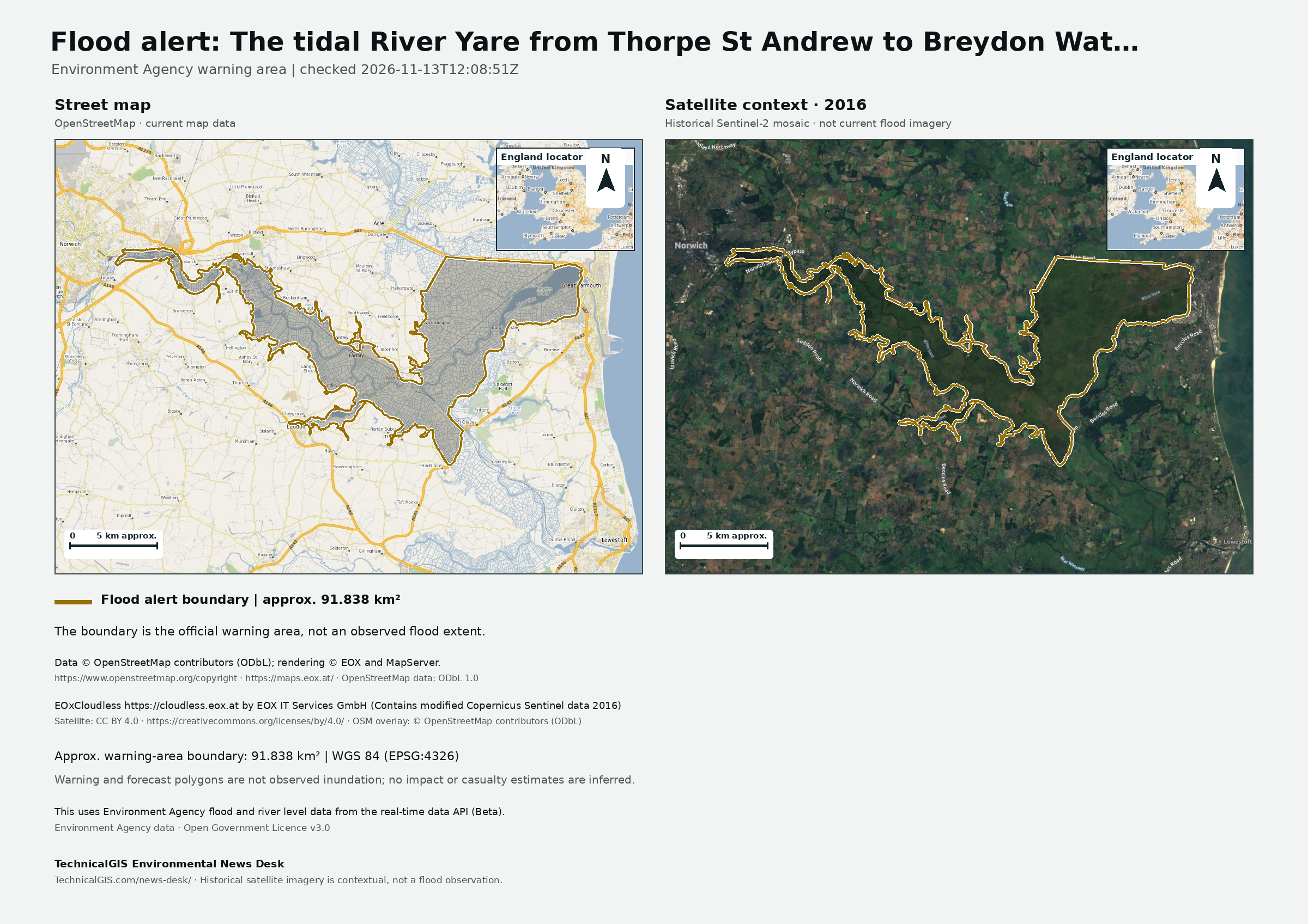
England flood packages show the Environment Agency’s official warning boundaries, not observed floodwater. A warning-area measurement is not a measurement of flooded land. The desk does not infer casualties, displacement or damage from those boundaries. Past warnings are labelled separately from current events; they remain available for reporting on earlier conditions.
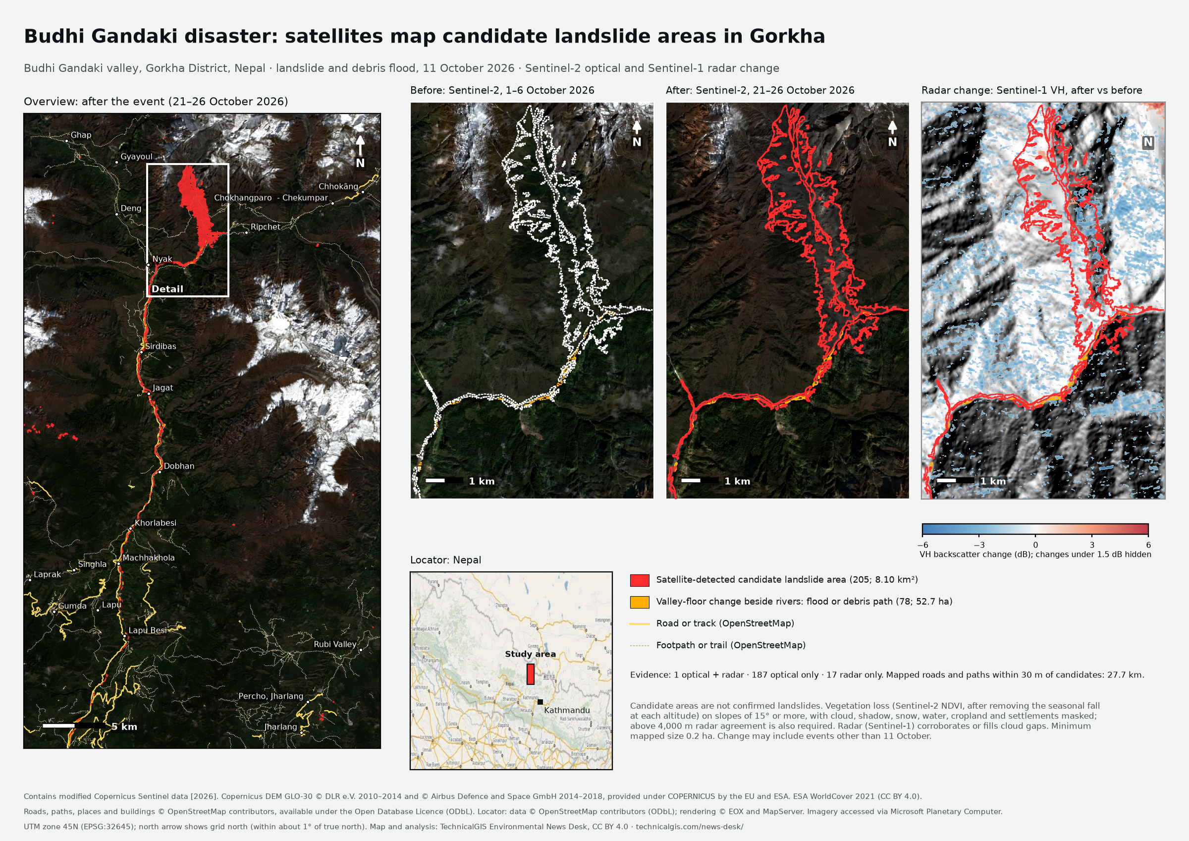
The Budhi Gandaki package uses satellite change analysis to identify candidate landslide areas, not confirmed landslides. Its briefing distinguishes the detected changes, confidence levels and reported impacts. Read those distinctions alongside the imagery dates before quoting a figure.
The live warning feed covers England. Wales, Scotland and Northern Ireland are not connected. The Nepal analysis is a separately prepared package, not continuous landslide monitoring.
Reuse, licences and credit
Start with the event’s briefing and manifest.json. They identify the data and map licences, required credit and any conditions that apply to derived outputs. A source being free to access does not make it free of reuse conditions.
Keep the attribution on the map when publishing it. If you crop or redraw a layout, put the full required credit beside the image and make clear what you changed. Credit the package as TechnicalGIS Environmental News Desk, link to its permanent event page and include the revision number. That credit supplements, rather than replaces, the source attributions.
Environment Agency warning data use the Open Government Licence v3.0 and require: “This uses Environment Agency flood and river level data from the real-time data API (Beta).” Street-map context uses OpenStreetMap data under the ODbL, credited to OpenStreetMap contributors. The flood layouts’ EOxCloudless 2016 satellite background uses CC BY 4.0; it is historical context, not a current image of a flood.
The Nepal package’s own map and candidate polygons use CC BY 4.0, with Copernicus credits retained. OpenStreetMap-derived attributes remain under the ODbL. Consult that package’s source list for the Sentinel, DEM and land-cover terms. Do not treat a composite map’s licence as permission to redistribute every underlying source without its conditions.
For tutorial figures and other site images, check the sources and licences on the original page. Contact us if the intended reuse is not covered.
Sources and methods
Each event page links its source records, imagery dates, calculations and revision history. The downloadable briefing explains the method; the GeoJSON and CSV carry the analytical results. Compare those with the manifest before using a number in reporting.
A source change creates a private draft. It does not silently replace a published package: an editor checks and approves the new revision first. Publication dates, revision numbers and earlier approved files remain visible on the event page.
If you spot an error, use the contact form and include the event URL, revision number, the figure or statement concerned and supporting evidence. We review corrections against the sources and publish an approved revision when a correction is needed. Earlier versions remain identifiable in the revision history. Do not assume a newer source observation has already been reviewed by the desk.
Press enquiries
Use the contact form for questions about a package, attribution, methods or a bespoke map. Include your publication, deadline and the event URL so we can identify the material. Subscribe to RSS for approved releases and updates.
Latest published packages
The list below includes both current events and clearly labelled past warnings. For current coverage, use the News Desk.
Satellite-detected surface water · Revision 1 · Published
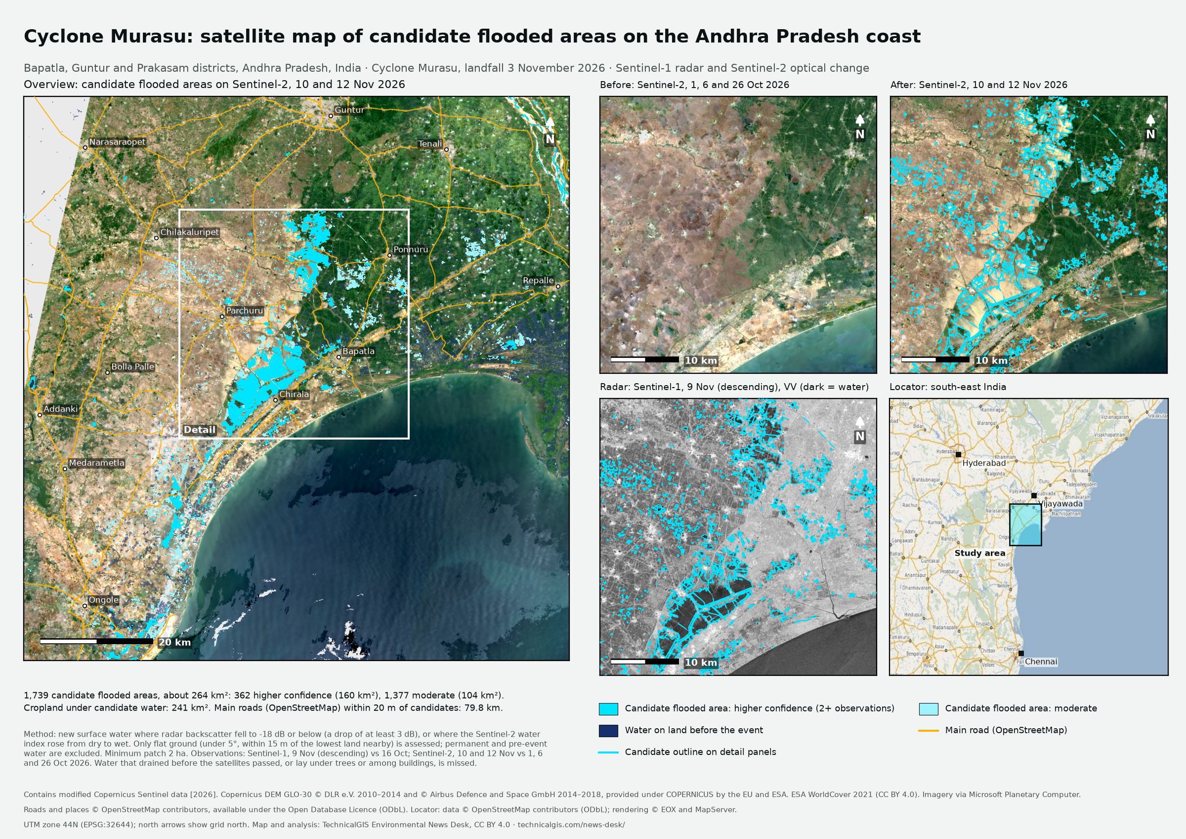
Sentinel radar and optical images show about 264 km² of new surface water on the Andhra Pradesh coast after Cyclone Murasu. The analysis compares pre-event imagery with observations taken after the storm.
Satellite-detected surface water · Revision 1 · Published
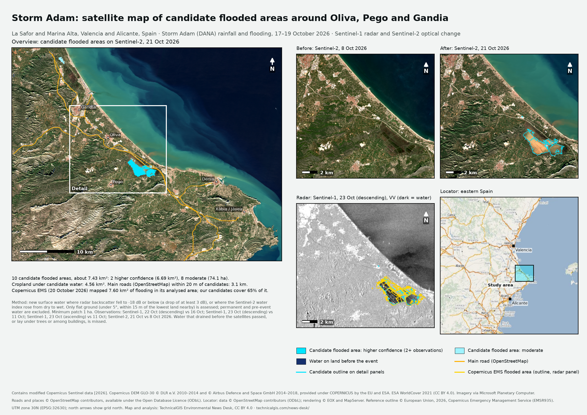
Sentinel radar and optical images show about 743 hectares of new surface water around Oliva, Pego and Gandia after Storm Adam. The analysis compares pre-event imagery with observations taken after the storm.
Sentinel radar and optical images show about 810 hectares of hillside change in Budhi Gandaki valley, Gorkha District, Nepal. The analysis compares imagery from before and after the disaster.
Past warning — no longer in force · Revision 3 · Published
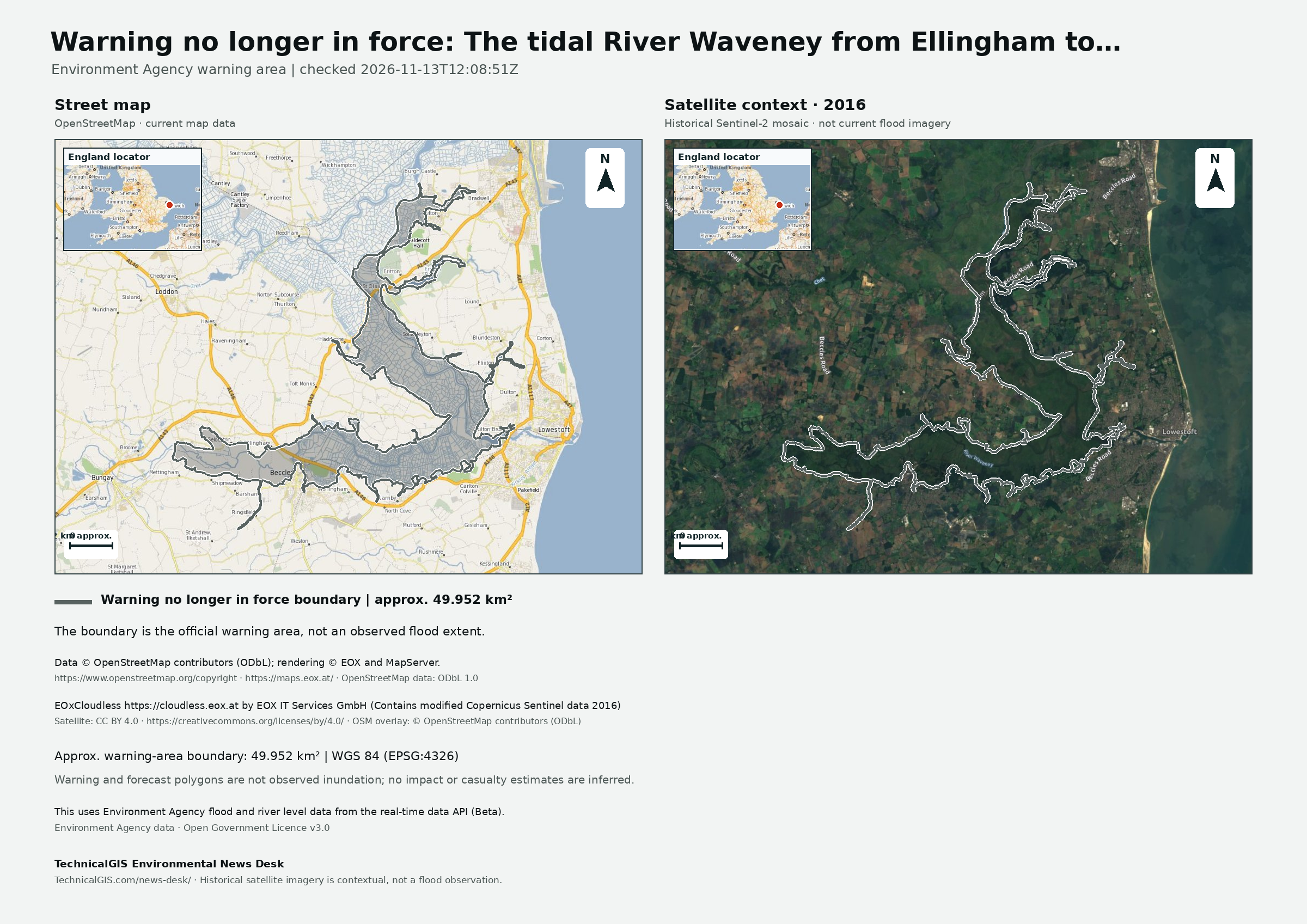
The Environment Agency reported that the flood warning for the tidal River Waveney from Ellingham to Breydon Water was no longer in force in its 13 November 2026 update.
Past warning — no longer in force · Revision 3 · Published
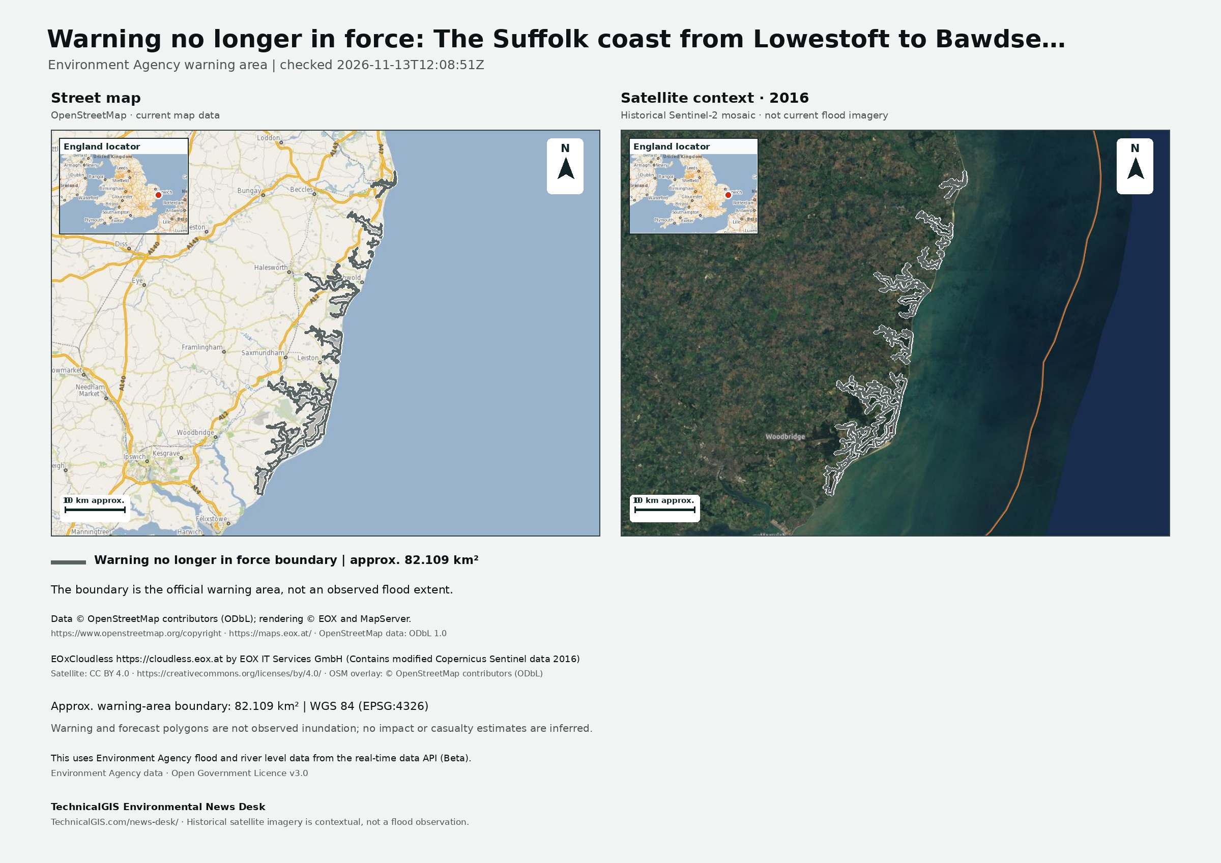
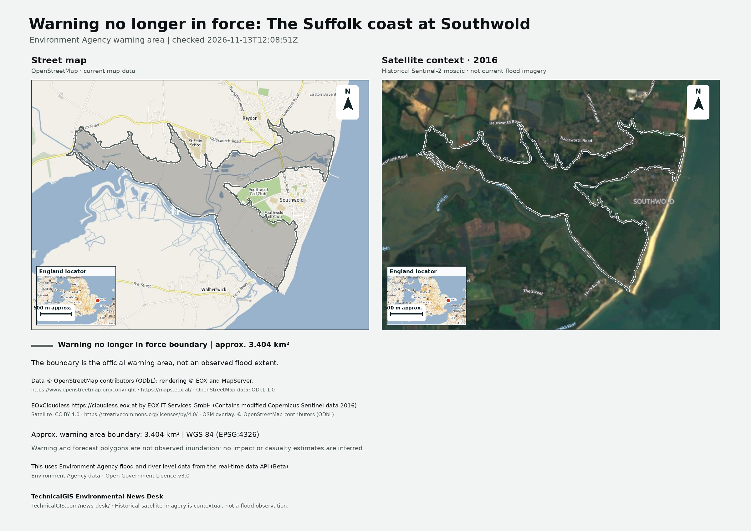
The Environment Agency reported that the flood warning for the Suffolk coast from Lowestoft to Bawdsey was no longer in force in its 13 November 2026 update.
Past warning — no longer in force · Revision 3 · Published
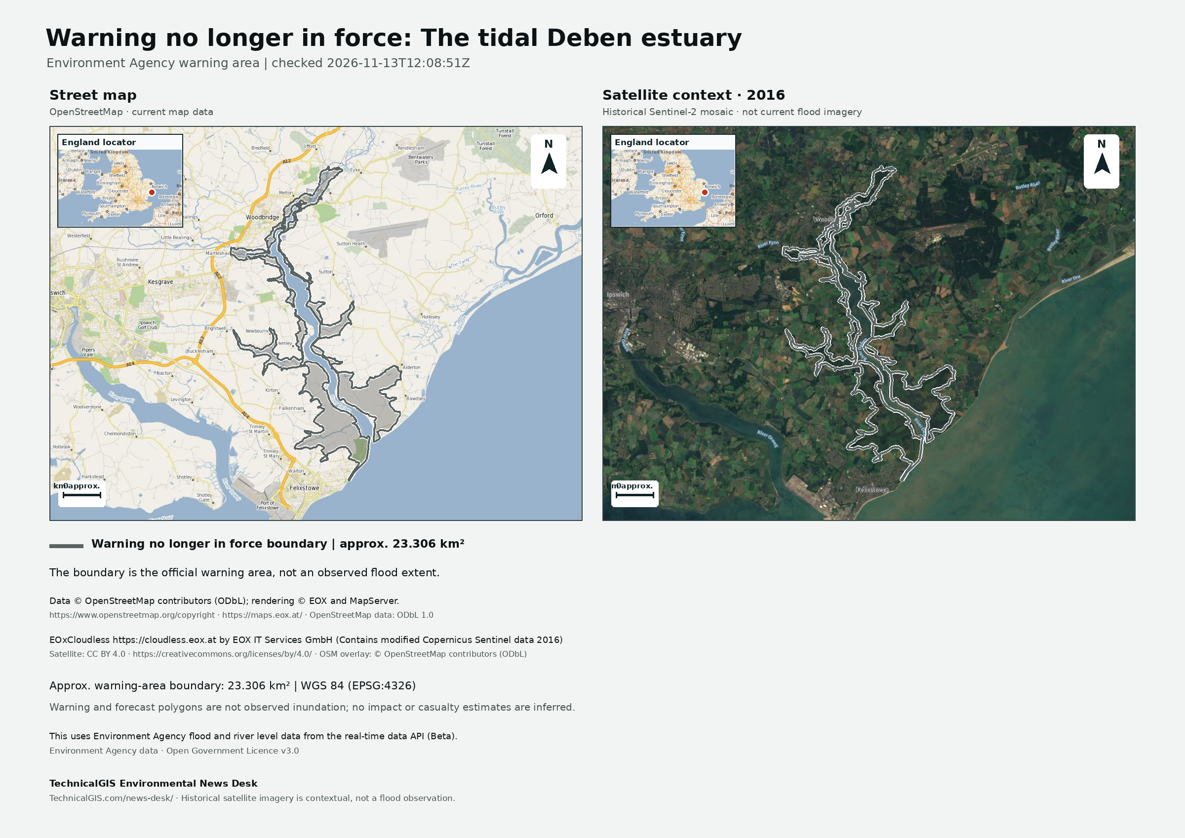
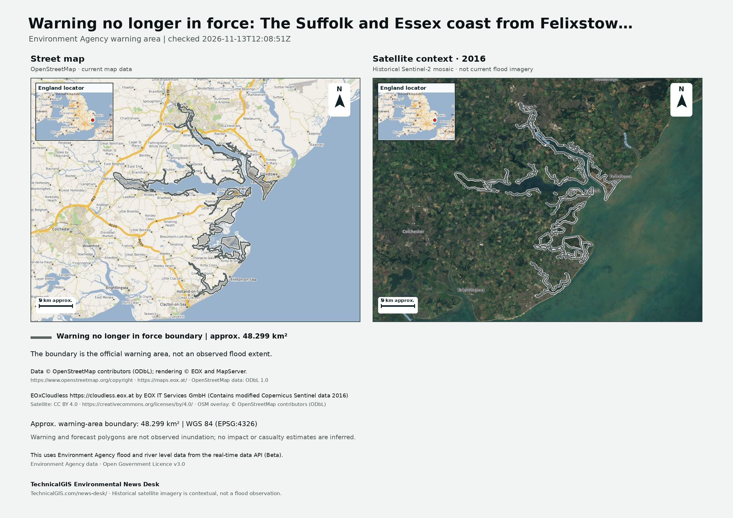
The Environment Agency reported that the flood warning for the Suffolk and Essex coast from Felixstowe to Clacton including Orwell and Stour estuaries was no longer in force in its 13 November 2026 update.
Past warning — no longer in force · Revision 3 · Published
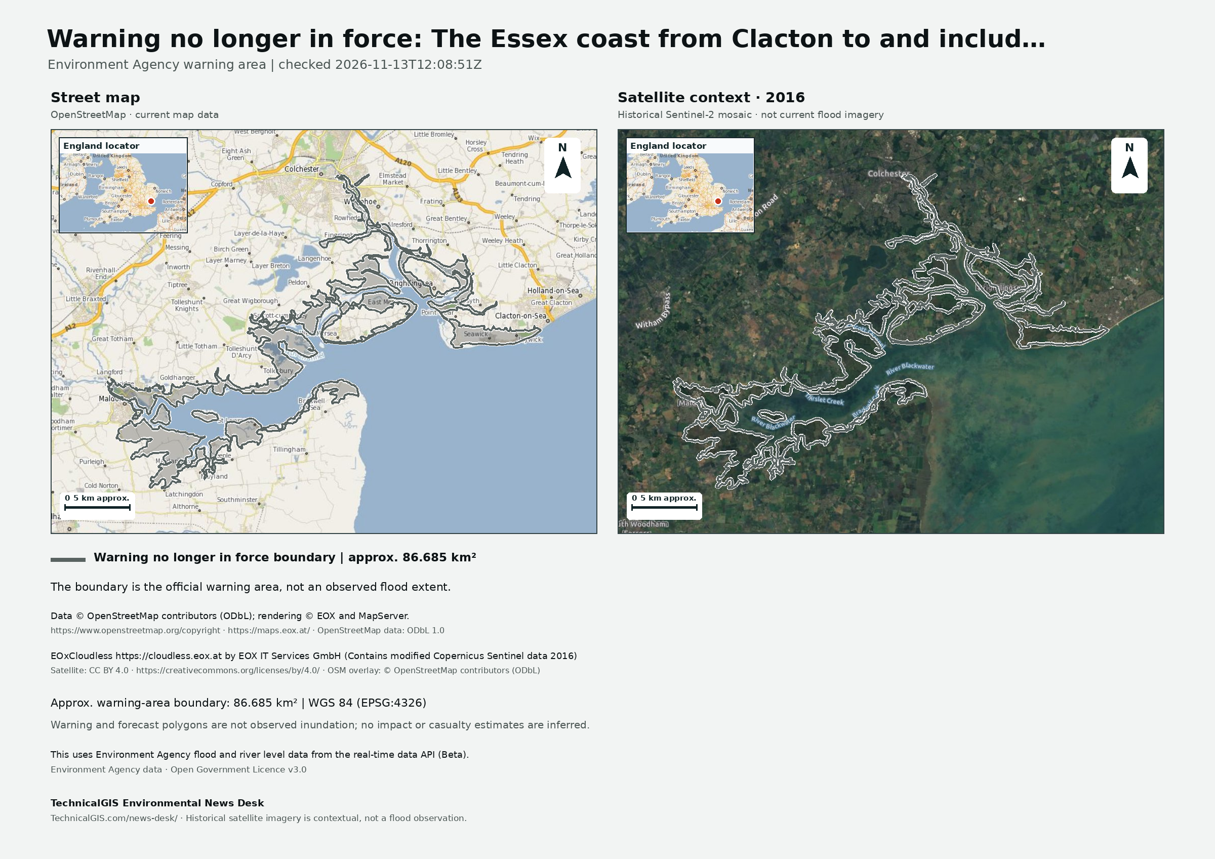
The Environment Agency reported that the flood warning for the Essex coast from Clacton to and including, St Peters Flat and the Colne and Blackwater estuaries was no longer in force in its 13 November 2026 update.
Past warning — no longer in force · Revision 4 · Published
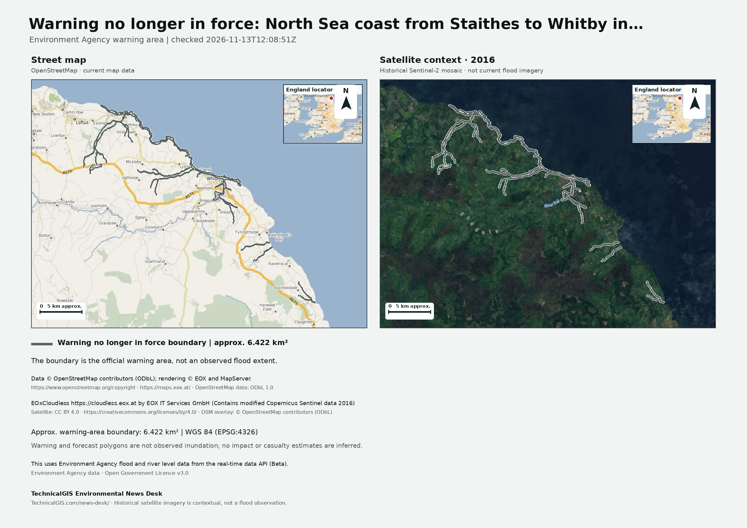
The Environment Agency reported that the flood warning for North Sea coast from Staithes to Whitby including tidal River Esk was no longer in force in its 13 November 2026 update.
Past warning — no longer in force · Revision 3 · Published
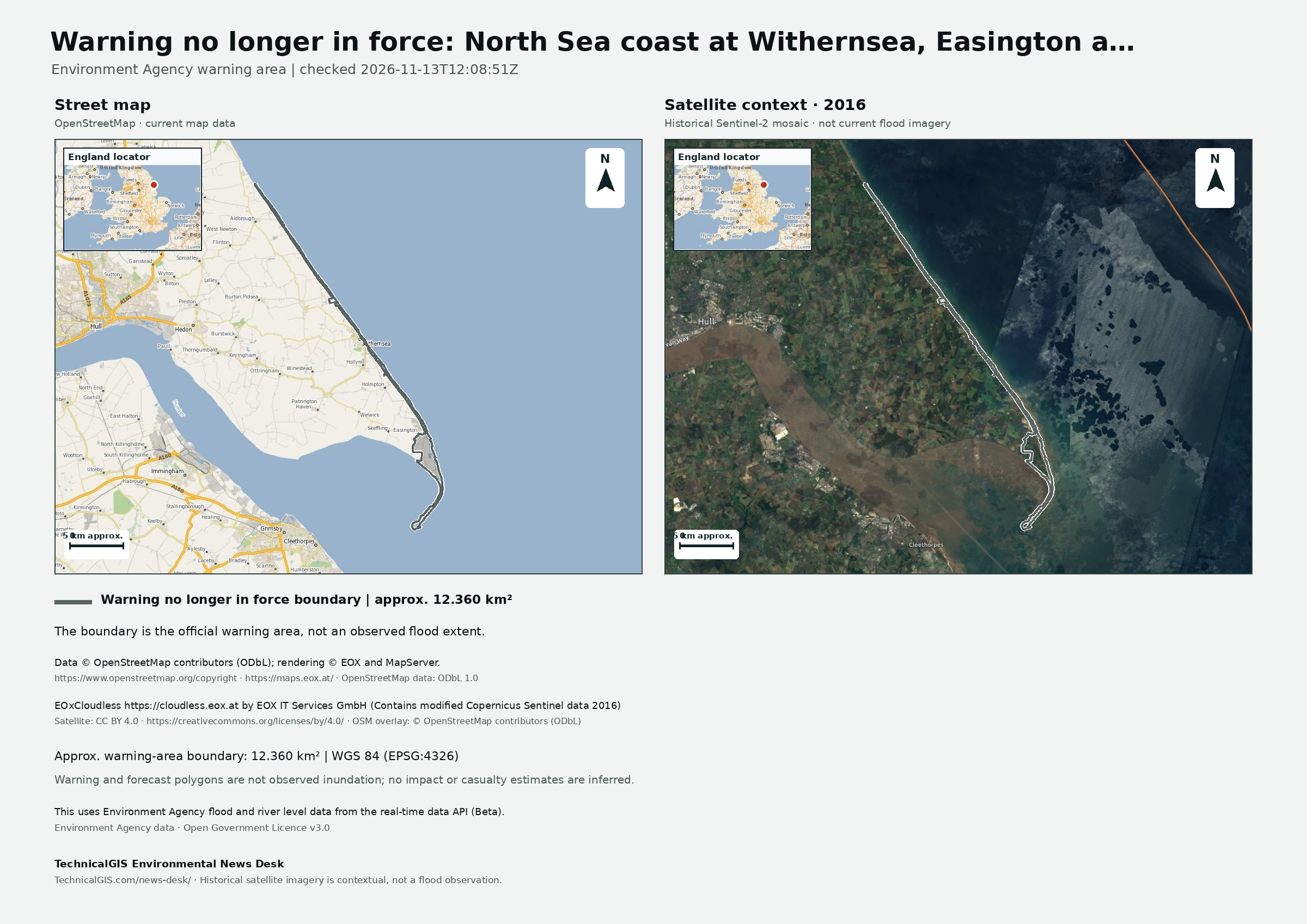
The Environment Agency reported that the flood warning for North Sea coast at Withernsea, Easington and Kilnsea was no longer in force in its 13 November 2026 update.