#Flood mapping

4 posts

Tutorial Python

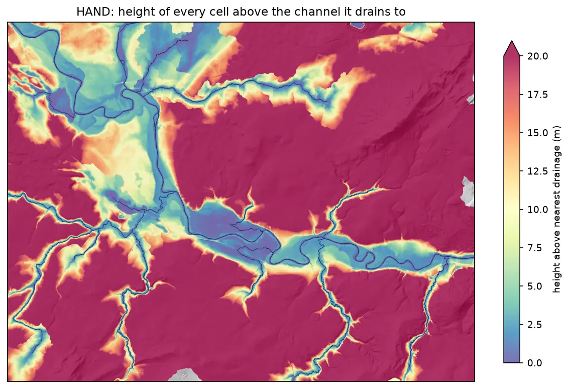
Height above nearest drainage (HAND) flood mapping in Python: the River Severn

Compute height above nearest drainage (HAND) from the Environment Agency LIDAR DTM at 5 m with pysheds, turn it into inundation extents for a range of stage heights on the River Severn between Shrewsbury and Buildwas, relate them to the Buildwas gauge, and score them honestly against the Environment Agency Flood Map for Planning with the hit rate, false-alarm ratio and critical success index.
Intermediate 13 min read

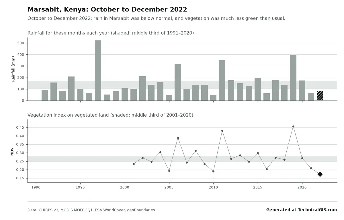
Season condition answer for Marsabit, Kenya, October to December 2022, with rainfall below normal and vegetation the lowest since 2001

Article Remote Sensing

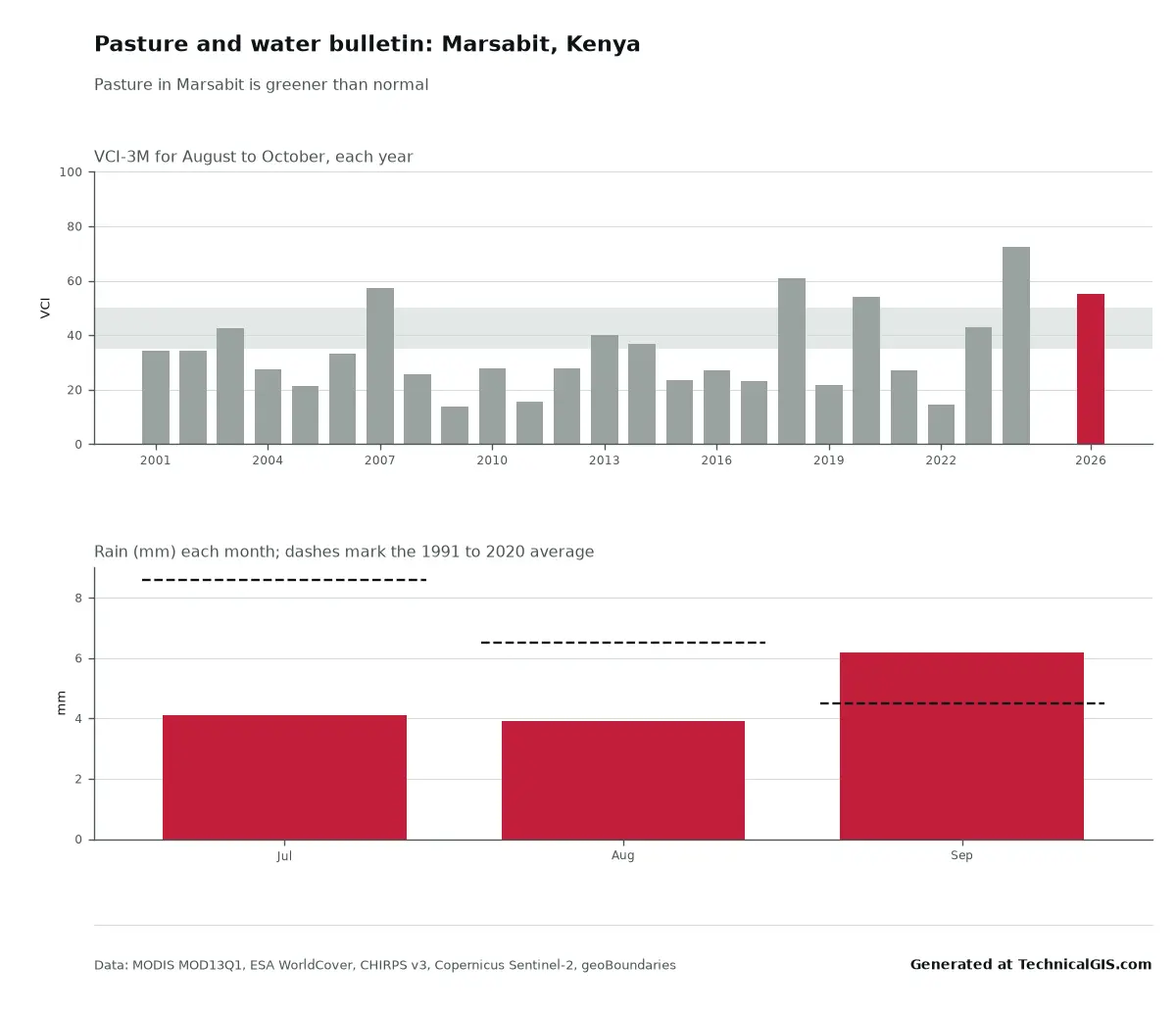
Free community tools: season condition and flood impact for any district

Two free tools for any district: is this season's rain and crop growth better or worse than usual, and where did it flood and how many people live there? Worked examples from Marsabit, Kenya, in 2022 and Feni, Bangladesh, in 2024.

Beginner 5 min read

Tutorial Python

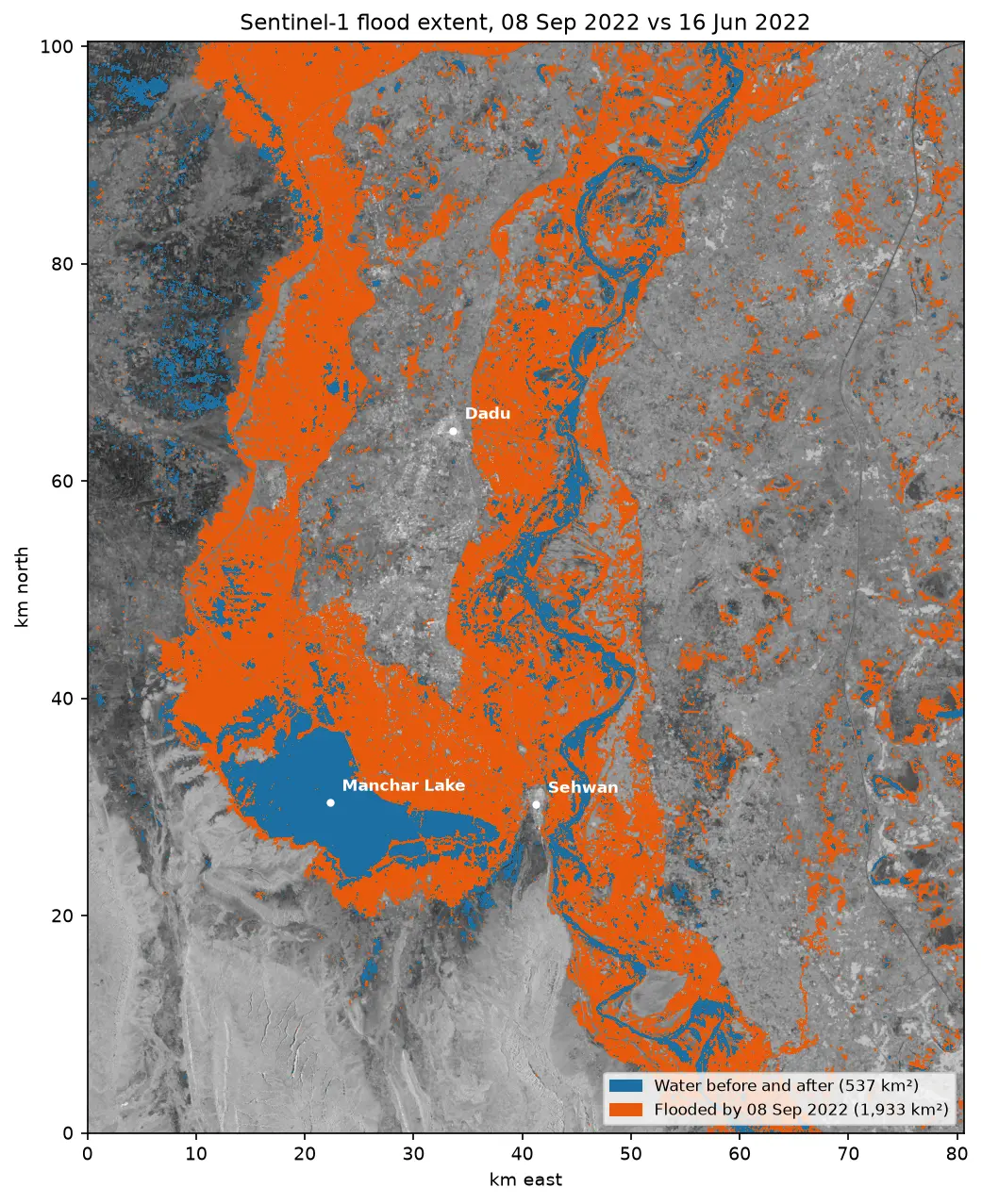
Sentinel-1 SAR flood mapping in Python: the 2022 Pakistan floods

Map the 2022 Sindh floods with free Sentinel-1 radar from the Microsoft Planetary Computer: convert backscatter to decibels, remove speckle with a Lee filter, pick a water threshold with Otsu's method, and measure the flood extent and how it receded over seven months.

Intermediate 10 min read