#IoU

2 posts

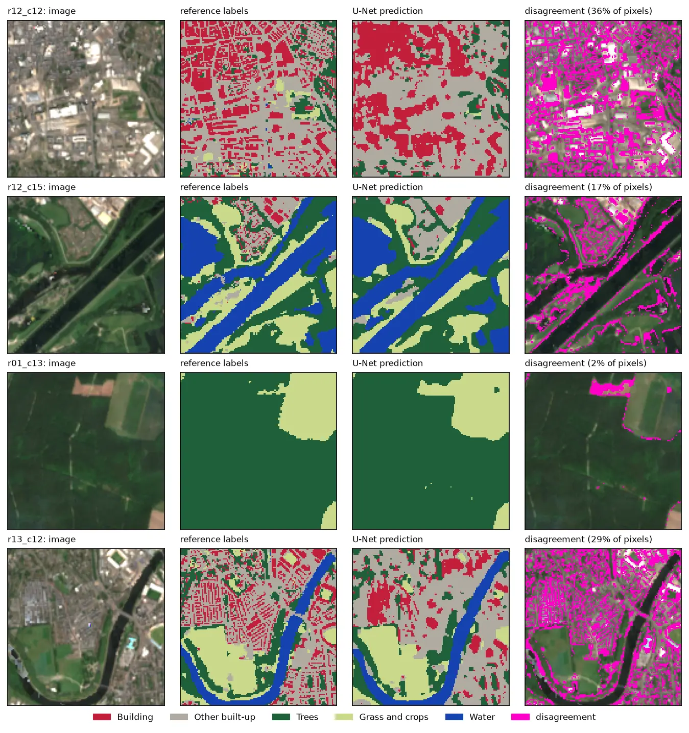
Four rows of Sentinel-2 test chips. Each row shows the image, the reference labels, the U-Net prediction and the disagreement in magenta. The prediction matches rivers, woods and fields closely, but in the city centre it draws buildings as blobs instead of separate roofs.

Tutorial Python Part 2 of 3

U-Net satellite image segmentation in PyTorch: a TorchGeo and Sentinel-2 tutorial on a CPU

Train a U-Net to segment Sentinel-2 imagery into buildings, built-up land, trees, grass and water with PyTorch, segmentation_models_pytorch and TorchGeo's Sentinel-2 pretrained ResNet-18 weights, on a CPU in five minutes. Real loss curves, per-class IoU and F1, a confusion matrix and an honest look at what limits accuracy.
Advanced 12 min read

Tutorial Python

Extract building footprints and heights from LiDAR in Python (USGS 3DEP, downtown Madison)

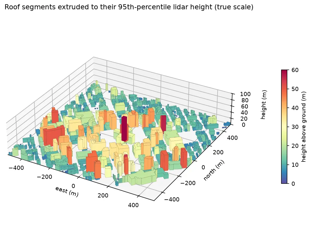
Turn classified LiDAR into building footprints with heights in Python: stream USGS 3DEP COPC tiles, build a DTM and a building nDSM from ASPRS class 6 points, polygonise and regularise the mask, split roofs at height steps, compute height statistics per building, score the result against OpenStreetMap with IoU, and export a GeoPackage and a 3D view.

Intermediate 15 min read