#Olofsson

2 posts

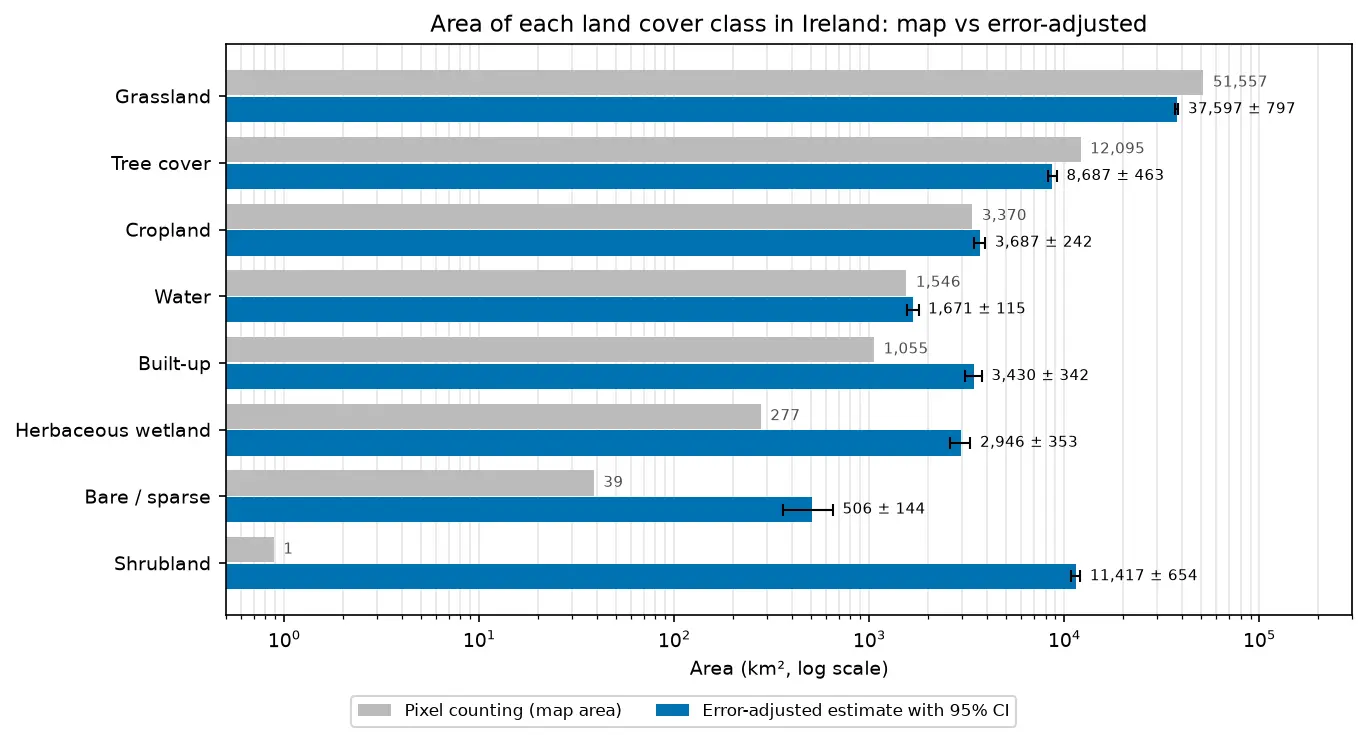
Bar chart comparing the area of each land cover class in Ireland from WorldCover pixel counting with the error-adjusted estimate and its 95% confidence interval.

Tutorial Remote Sensing

Land cover accuracy assessment in Python: confusion matrix, Olofsson area estimates and sample size

Assess a real land cover map in Python: ESA WorldCover 2021 against 8,597 Eurostat LUCAS 2022 field survey points in Ireland. Build the confusion matrix, compute overall, user's and producer's accuracy, see why kappa is discouraged, and use the Olofsson et al. (2014) stratified estimators to get error-adjusted areas with 95% confidence intervals and to plan a new stratified random sample.
Advanced 20 min read

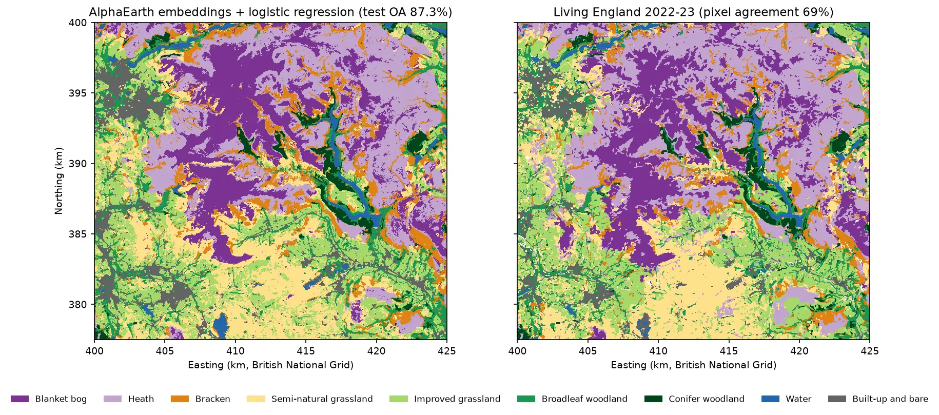
Two habitat maps of the Dark Peak side by side. Left: the map from AlphaEarth embeddings and logistic regression, with large purple blanket bog areas on Kinder Scout and Bleaklow, lilac heath around them, orange bracken on the valley sides, yellow and light green grassland in the south and west, and blue reservoirs in the Derwent valley. Right: Living England 2022-23 for the same area, with very similar patterns.

Tutorial Python Part 5 of 5

AlphaEarth satellite embeddings in Python: few-shot habitat mapping, uncertainty and area estimates

Use Google DeepMind's AlphaEarth Foundations satellite embeddings, a geospatial foundation model, in Python without a login. Classify nine Peak District habitats with a linear model, compare a few-shot learning curve against raw Sentinel-2 bands, map uncertainty, check calibration, simulate active learning, and estimate habitat areas with confidence intervals from a stratified random sample (Olofsson et al. 2014).

Advanced 24 min read