#Otsu

2 posts

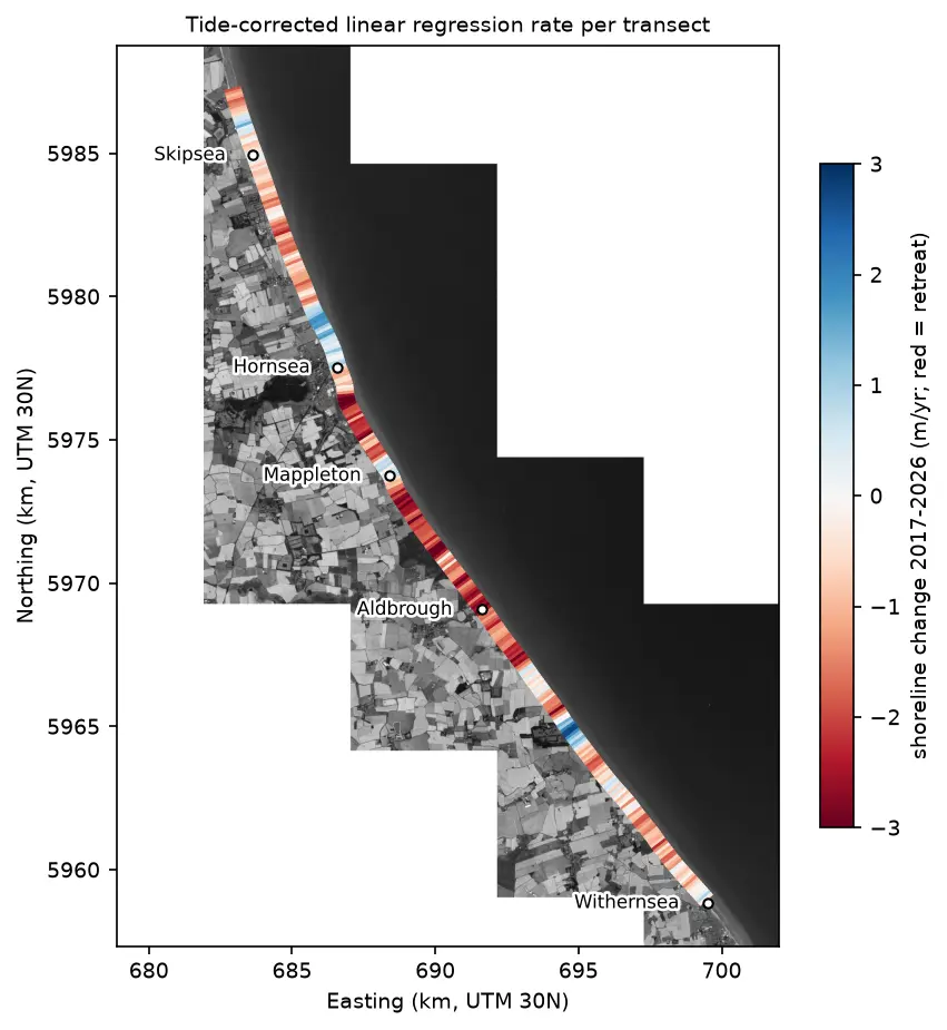
Map of the Holderness coast from Skipsea to Withernsea in greyscale Sentinel-2, with each 100 m transect coloured by its shoreline change rate from 2017 to 2026: mostly red (retreat), with blue (advance) patches north of Hornsea, at Mappleton and near Grimston.

Tutorial Python

Coastal erosion and shoreline change from Sentinel-2 in Python (Holderness, 2017–2026)

Measure shoreline change on one of Europe's fastest-eroding coasts with free Sentinel-2 imagery and Python: MNDWI and Otsu thresholding, sub-pixel shorelines with find_contours, shore-normal transects, a tide correction from open tide-gauge data, end-point and linear regression rates, and an honest comparison with East Riding of Yorkshire Council's cliff monitoring.
Advanced 21 min read

Tutorial Python

Sentinel-1 SAR flood mapping in Python: the 2022 Pakistan floods

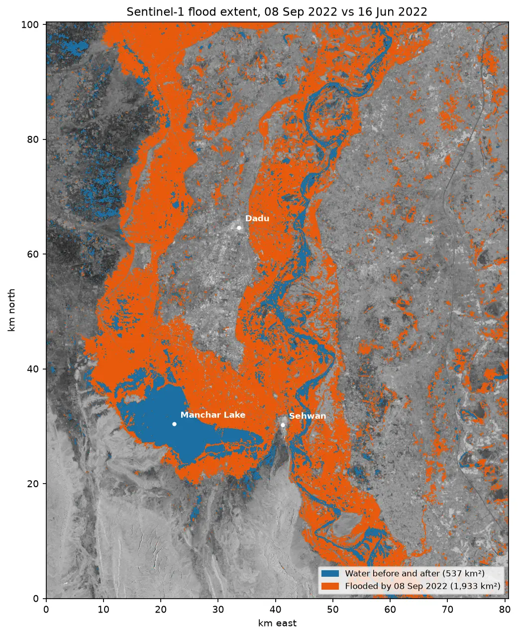
Map the 2022 Sindh floods with free Sentinel-1 radar from the Microsoft Planetary Computer: convert backscatter to decibels, remove speckle with a Lee filter, pick a water threshold with Otsu's method, and measure the flood extent and how it receded over seven months.

Intermediate 10 min read