#Planetary Computer

26 posts

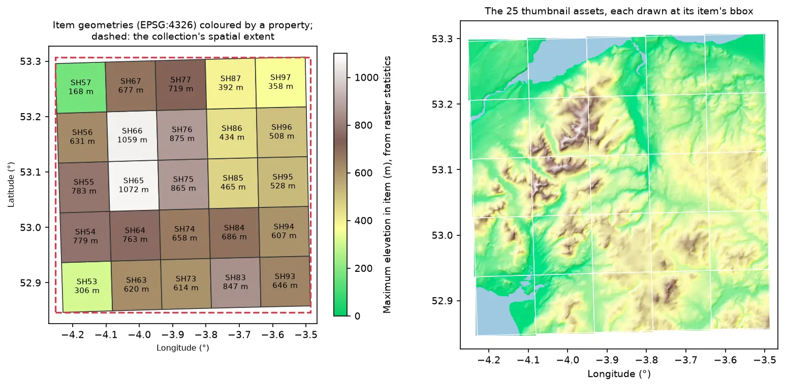
Two maps of Eryri in longitude and latitude. Left: 25 slightly rotated STAC item footprints labelled SH53 to SH97 and coloured by maximum elevation, inside a dashed red collection extent. Right: the 25 hillshaded thumbnail assets drawn at their item bounding boxes, forming one relief map

Tutorial Python Part 2 of 2

Build a STAC catalogue in Python with pystac, rio-stac and pystac-client

Turn 25 Cloud Optimised GeoTIFFs of Eryri into a static STAC catalogue with pystac and rio-stac, validate it against the JSON schemas, query it, serve it as static files, and compare it with the Earth Search and Planetary Computer STAC APIs through pystac-client.

Intermediate 12 min read

Tutorial Python

Parallel raster processing in Python with dask and rioxarray: a whole Sentinel-2 tile without running out of memory

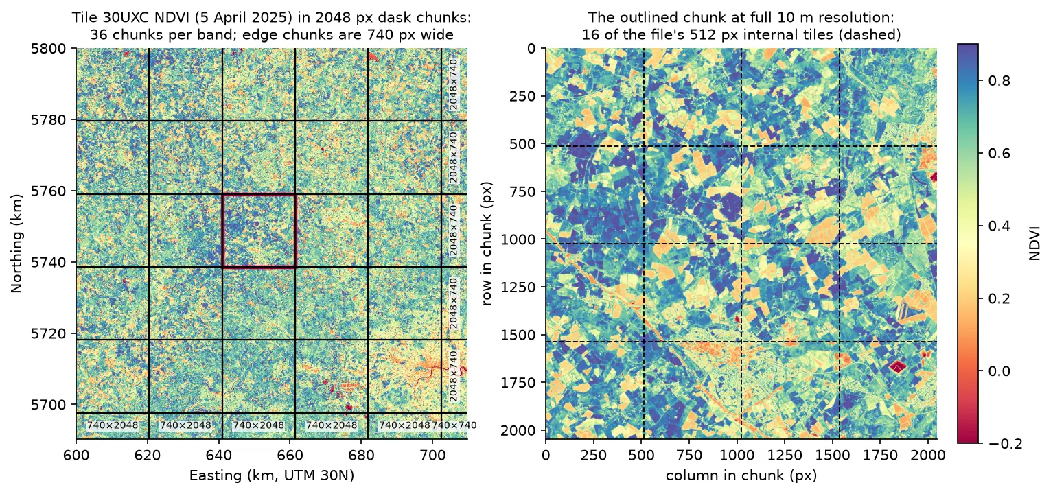
Process large satellite rasters in Python with dask and rioxarray. Open eight full Sentinel-2 scenes lazily, choose a chunk size, inspect the task graph, watch CPU and memory with dask diagnostics, compare peak memory with eager NumPy, time chunk sizes and thread counts, and write a median NDVI GeoTIFF to disk chunk by chunk.

Intermediate 17 min read

Tutorial Python

Satellite timelapse in Python: a Sentinel-2 GIF, WebP and MP4 of Hinkley Point C

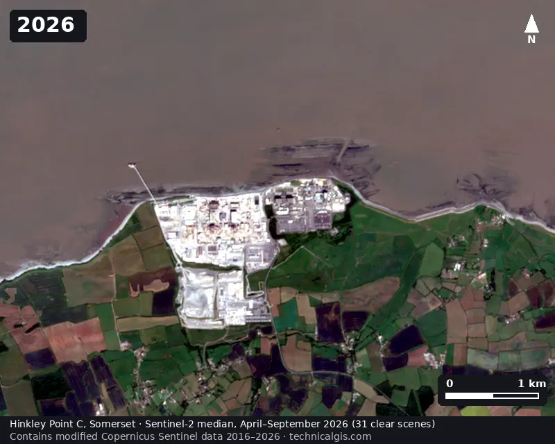
Create a satellite timelapse in Python from free Sentinel-2 imagery. Select clear scenes with STAC, mask cloud, build one median composite per summer, apply a consistent stretch, add date labels and a scale bar, and export an animated GIF, WebP and MP4 of eleven years of construction at Hinkley Point C.

Intermediate 13 min read

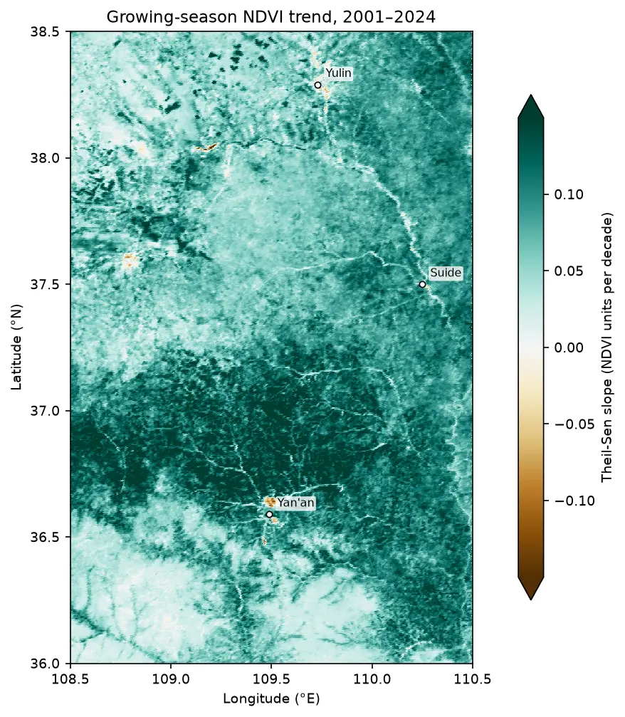
Map of the Theil-Sen slope of growing-season NDVI from 2001 to 2024 on the Loess Plateau between Yan'an and Yulin, almost entirely teal (greening), with a few brown browning patches near Yan'an and Yulin.

Tutorial Remote Sensing

Mann-Kendall trend test on rasters in Python: Theil-Sen NDVI trends with xarray

Run a pixel-wise Mann-Kendall trend test and Theil-Sen slope on 24 years of MODIS NDVI in Python. Read MOD13A1 from the Microsoft Planetary Computer, mask it with the QA layer, aggregate to growing-season means, vectorise the tests with xarray.apply_ufunc (checked against pymannkendall), compare the seasonal and modified Mann-Kendall tests, control the false discovery rate across 229,229 pixels, and map greening and browning on China's Loess Plateau.

Advanced 16 min read

Tutorial Python

Sentinel-1 soil moisture in Python: change detection checked against COSMOS-UK

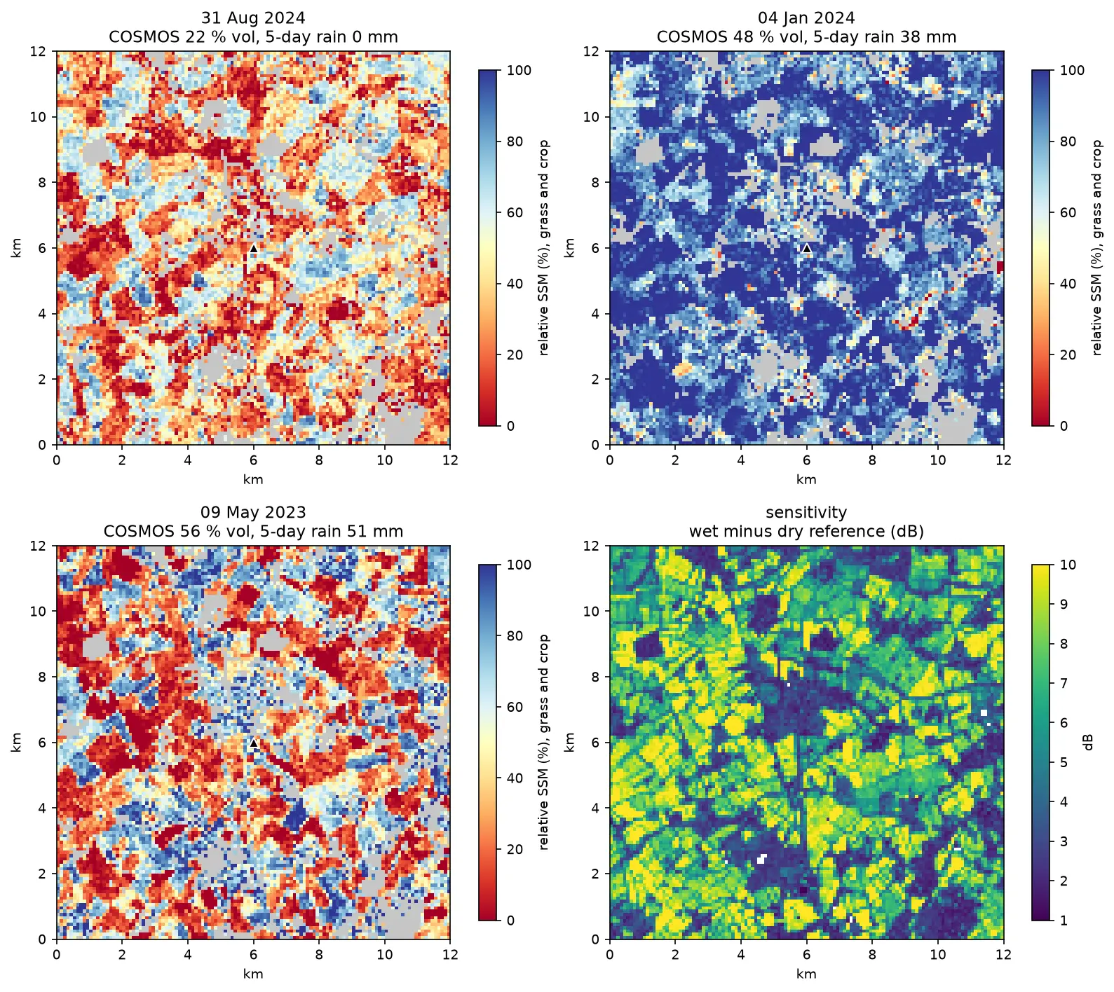
Estimate surface soil moisture from free Sentinel-1 radar in Python with the TU Wien change-detection method. Build dry and wet references per orbit, map relative soil moisture at 100 m, and test it honestly against four COSMOS-UK stations and their rain gauges.

Intermediate 13 min read

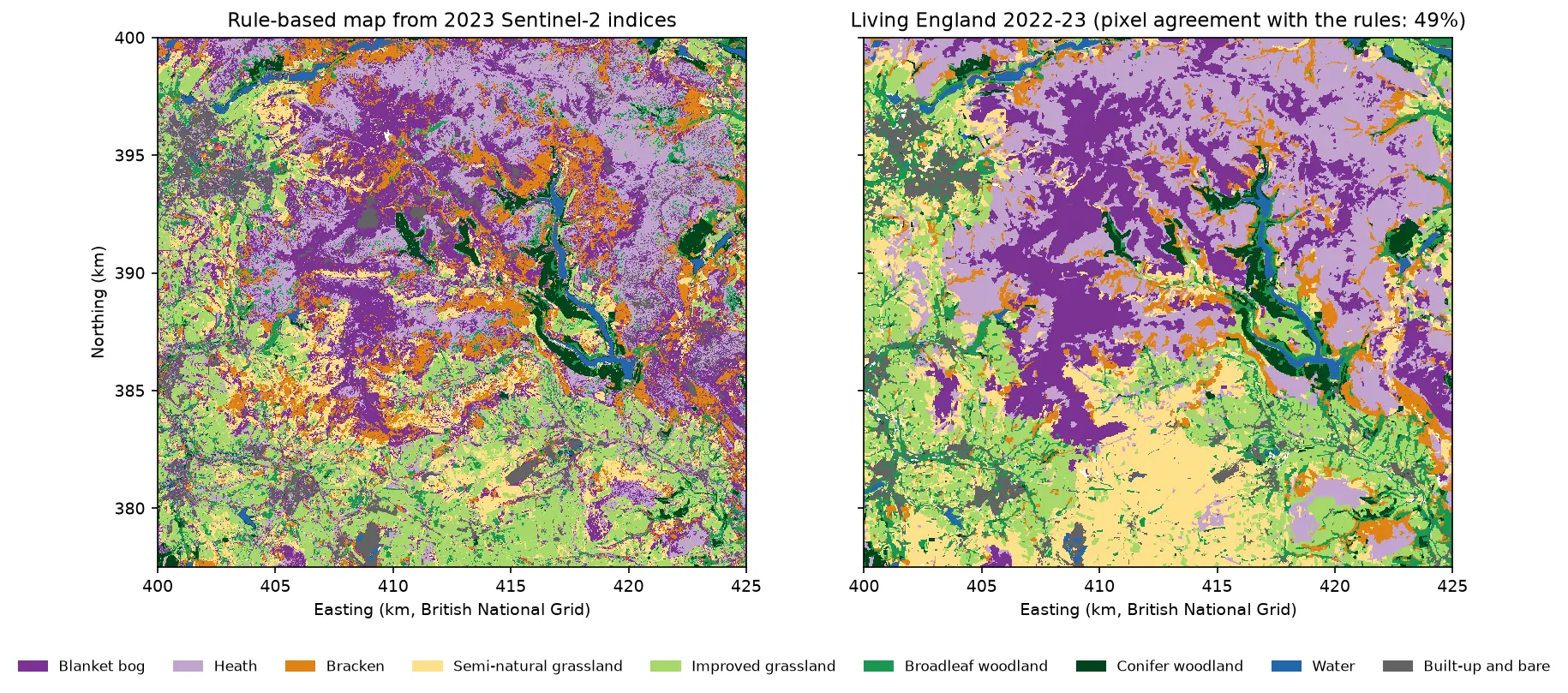
Two habitat maps of the Dark Peak side by side. Left: the rule-based map from Sentinel-2, with purple blanket bog and lilac heath on the Kinder and Bleaklow plateaux, orange bracken on the valley sides, green grassland and woodland in the valleys and blue reservoirs in the Derwent valley. Right: Living England 2022-23 for the same area, with smoother patches of the same classes.

Tutorial Python Part 1 of 5

Habitat mapping with Sentinel-2 in Python: spectral index rules and an honest accuracy assessment

Map blanket bog, heath, bracken, grassland, woodland, water and built-up land in the Peak District from 2023 Sentinel-2 seasonal composites with an eight-rule spectral index classifier, then assess it properly: a confusion matrix, user's and producer's accuracy, kappa and its caveats, block-bootstrap confidence intervals, and why a random train/test split overstates accuracy.

Beginner 19 min read

Tutorial Python

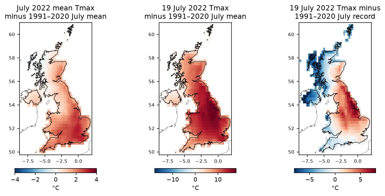
ERA5 in Python with xarray: mapping the July 2022 UK heatwave

Read ERA5 climate reanalysis in Python with xarray from free, login-free cloud Zarr stores, clip it to the UK, compute area-weighted means and anomalies against 1991–2020, export a Cloud Optimised GeoTIFF and check it against Met Office stations.

Intermediate 13 min read

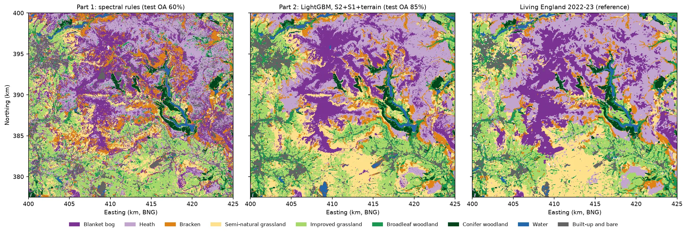
Three habitat maps of the Dark Peak side by side. Left: the noisy Part 1 rule-based map. Centre: the LightGBM map, with smooth purple blanket bog on the Kinder and Bleaklow plateaux, lilac heath around them, orange bracken on the valley sides, yellow semi-natural grassland in the south, green grassland and woodland in the valleys and blue reservoirs. Right: Living England 2022-23, which the LightGBM map closely resembles.

Tutorial Python Part 2 of 5

Habitat classification with LightGBM in Python: Sentinel-2, Sentinel-1 and terrain fusion

Classify nine upland habitats in the Peak District with LightGBM on 77 multi-temporal features: seasonal Sentinel-2 bands and indices, Sentinel-1 VV and VH backscatter and Copernicus DEM terrain. Tune with spatial-fold cross-validation and class weights, run an S2 / S2+S1 / S2+S1+terrain ablation, explain the model with TreeSHAP and permutation importance, and compare it with a random forest and the Part 1 rules on the same test blocks.

Intermediate 21 min read

Tutorial Python

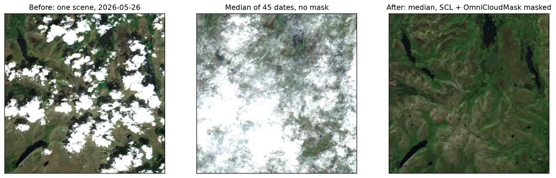
Sentinel-2 cloud and cloud-shadow masking in Python: SCL vs s2cloudless vs OmniCloudMask

Mask clouds and cloud shadows in Sentinel-2 L2A imagery with Python. Compare the Scene Classification Layer (SCL), s2cloudless, OmniCloudMask and a simple threshold over the Lake District, measure how far they agree, score them against 186 reference points and build a cloud-free median composite.

Intermediate 15 min read

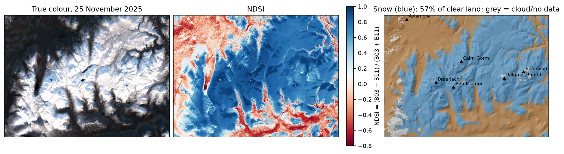
Three panels of the Cairngorms on 25 November 2025: a true-colour Sentinel-2 image with snow on the plateaux and long shadows in the glens; the NDSI, blue over snow and red over forest and bare ground; and a snow map over hillshade, with snow in blue on the high ground around Cairn Gorm, Ben Macdui, Braeriach, Beinn a' Bhuird and Ben Avon, covering 57% of the clear land.

Tutorial Python

Snow cover mapping with NDSI in Python: Sentinel-2 and MODIS over the Cairngorms

Map snow cover in Python with the Normalised Difference Snow Index (NDSI) from Sentinel-2 and the daily MODIS snow product on the Microsoft Planetary Computer: choosing the NDSI threshold, separating snow from cloud, snow-covered area through the winter of 2025–26 in the Cairngorms, and the snowline by elevation and aspect with the Copernicus DEM.

Intermediate 15 min read

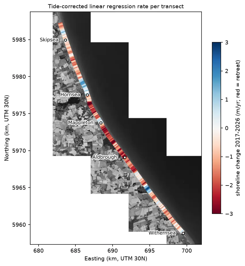
Map of the Holderness coast from Skipsea to Withernsea in greyscale Sentinel-2, with each 100 m transect coloured by its shoreline change rate from 2017 to 2026: mostly red (retreat), with blue (advance) patches north of Hornsea, at Mappleton and near Grimston.

Tutorial Python

Coastal erosion and shoreline change from Sentinel-2 in Python (Holderness, 2017–2026)

Measure shoreline change on one of Europe's fastest-eroding coasts with free Sentinel-2 imagery and Python: MNDWI and Otsu thresholding, sub-pixel shorelines with find_contours, shore-normal transects, a tide correction from open tide-gauge data, end-point and linear regression rates, and an honest comparison with East Riding of Yorkshire Council's cliff monitoring.

Advanced 21 min read

Tutorial Python

Deforestation detection in Python with Global Forest Change data (Rondônia, 2001–2025)

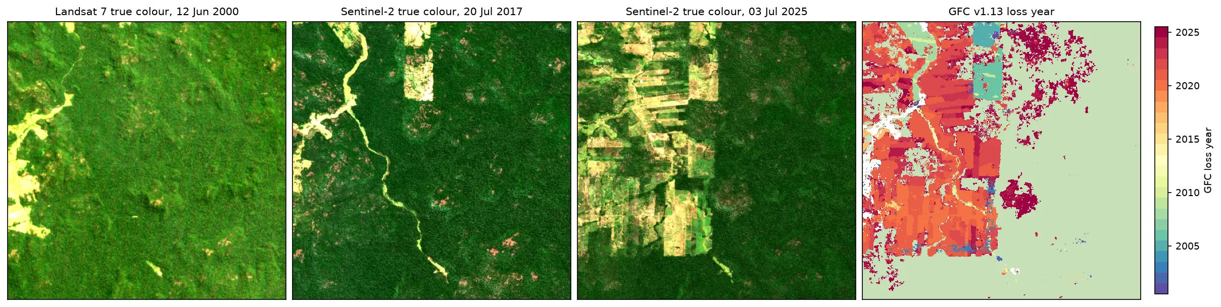
Map forest loss and deforestation in Python with the Hansen/UMD Global Forest Change v1.13 data: read the open tiles with no login, compute loss by year in hectares with correct pixel areas, compare Landsat and Sentinel-2 images before and after, and check the GFC loss year against Sentinel-2 NBR and MODIS burned area for central Rondônia, Brazil.

Intermediate 15 min read

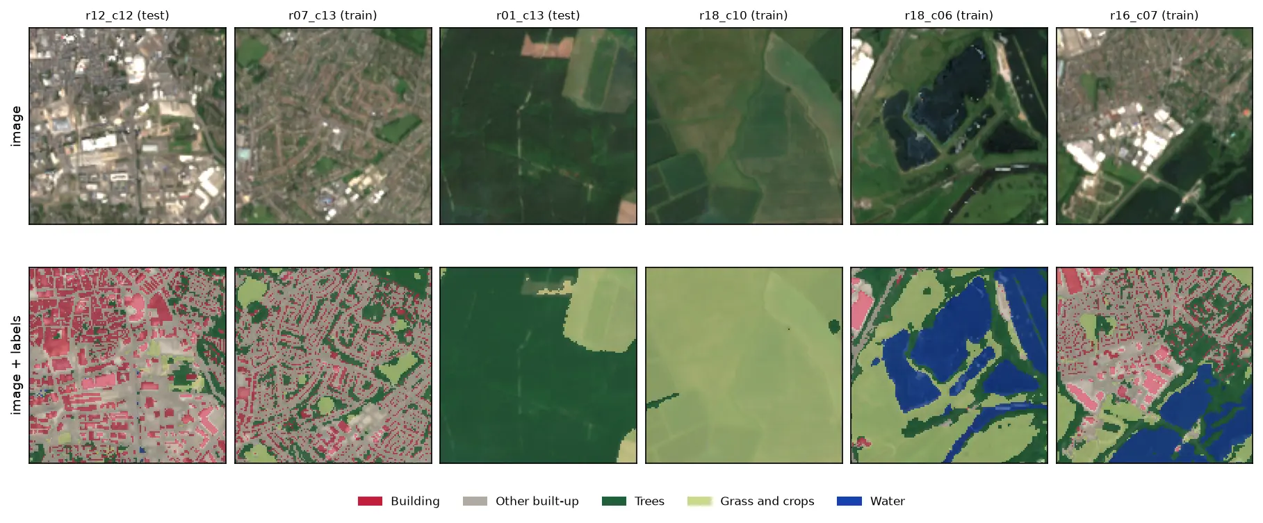
Six 128 by 128 pixel Sentinel-2 image chips of Nottingham, each shown above the same chip with its label mask overlaid: a city centre with red buildings and grey streets, a suburb, a forest, farmland, flooded gravel pits in blue and an industrial estate.

Tutorial Python Part 1 of 3

Training data for deep learning on satellite imagery: Sentinel-2 image chips in Python

Build a labelled deep learning dataset from free data: stream a Sentinel-2 L2A composite from the Planetary Computer, rasterise Overture building footprints over ESA WorldCover, cut georeferenced image chips, split them by spatial block so the test set does not leak, check the class balance and load it all as a TorchGeo dataset.

Intermediate 13 min read

Tutorial Python Part 1 of 2

Sentinel-5P NO₂ in Python: mapping air pollution from TROPOMI over the UK and north-west Europe

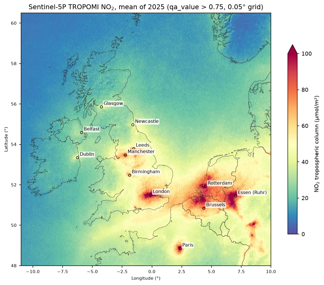
Map nitrogen dioxide air pollution from Sentinel-5P TROPOMI Level-2 data in Python: stream a full year of orbits from the Planetary Computer, apply the qa_value > 0.75 filter, grid swaths to a regular raster, build monthly and seasonal composites, rank cities and measure the weekend drop, with an honest explanation of what a tropospheric column is.

Intermediate 17 min read

Tutorial Python

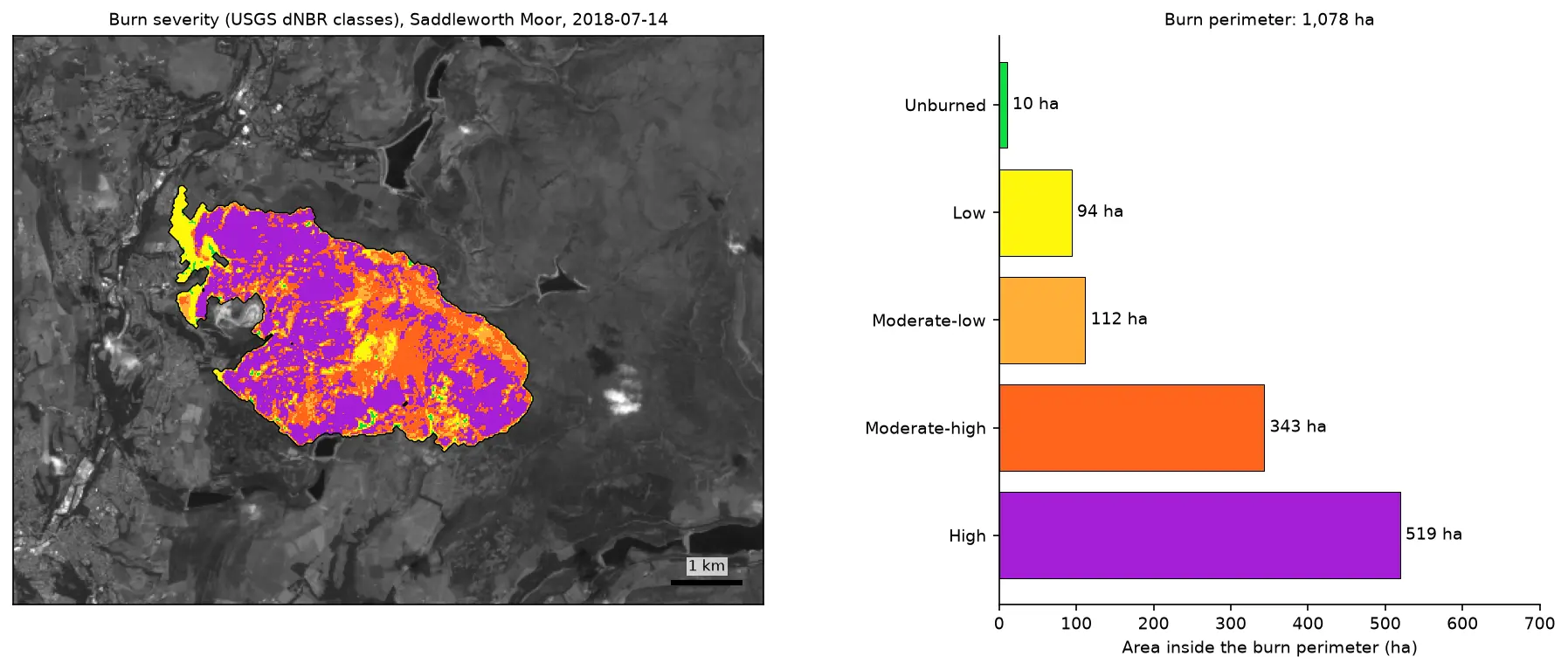
Burn severity mapping with Sentinel-2 and dNBR in Python (Saddleworth Moor 2018)

Map wildfire burn severity in Python with free Sentinel-2 imagery: NBR calculation, cloud and water masking with SCL, dNBR with an offset, USGS severity classes and burned hectares, a burn perimeter, fire progression, RdNBR and an eight-year recovery record for the 2018 Saddleworth Moor fire.

Intermediate 15 min read

Tutorial Python

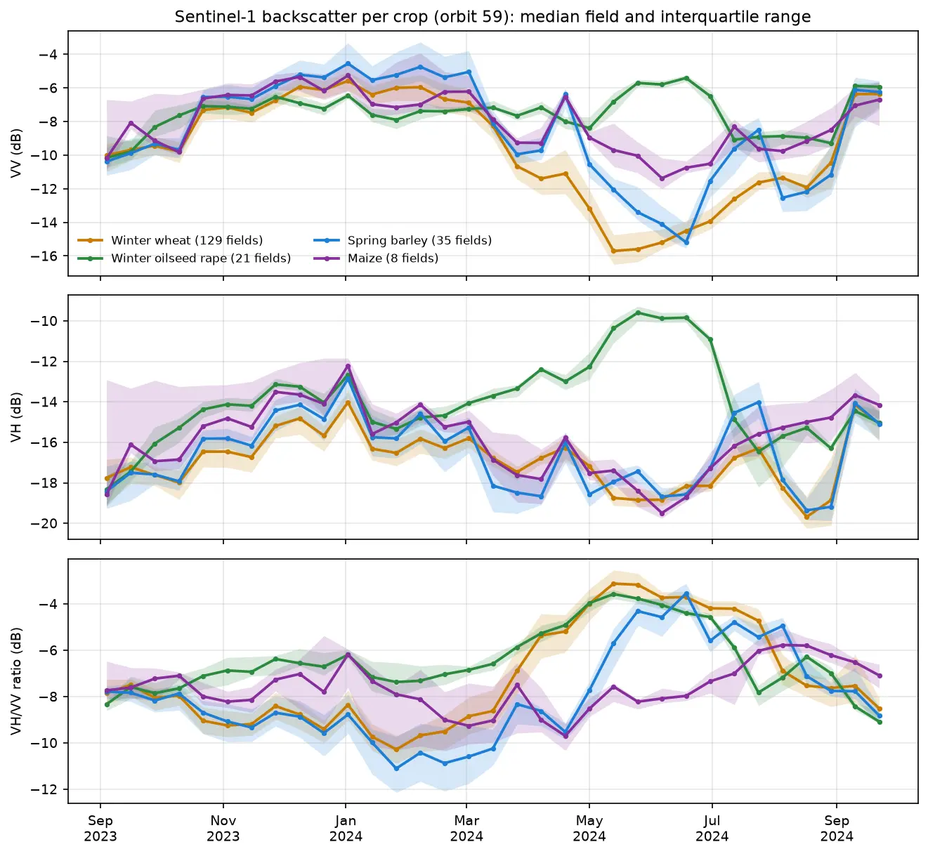
Sentinel-1 crop monitoring in Python: SAR time series for wheat and oilseed rape

Monitor crops through cloud with free Sentinel-1 radar. Build VV, VH and VH/VV ratio time series for 247 fields in Cambridgeshire, beat speckle by field-averaging, read the growth signatures of winter wheat and oilseed rape, and compare with the gaps that cloud leaves in Sentinel-2 NDVI.

Intermediate 16 min read

Tutorial Python

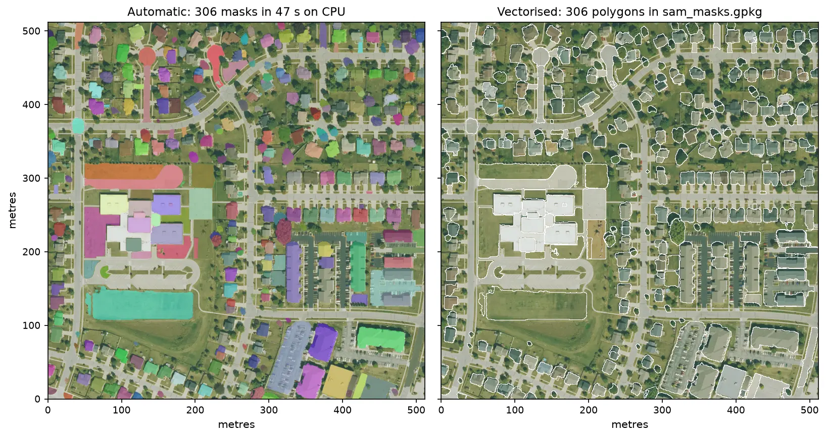
Segment Anything on satellite and aerial imagery in Python: a samgeo tutorial

Run Meta's Segment Anything Model on high-resolution aerial imagery with segment-geospatial (samgeo), on a CPU. Generate masks automatically, vectorise them to a GeoPackage, filter them by area, shape and NDVI to find buildings, and prompt SAM with points and boxes, checked against OpenStreetMap.

Intermediate 14 min read

Tutorial Python

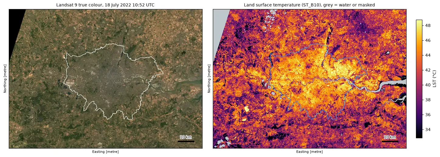
Land surface temperature from Landsat in Python: mapping London's urban heat island

Calculate land surface temperature from Landsat 8 and 9 Collection 2 Level-2 data in Python: ST_B10 scale and offset, QA_PIXEL cloud masking, LST by land cover and NDVI, an urban-rural transect, hotspots with OpenStreetMap and an honest comparison with air temperature, for London in the July 2022 heatwave.

Intermediate 17 min read

Tutorial Python

Sentinel-1 ship detection in Python: a CA-CFAR detector off the Port of Rotterdam

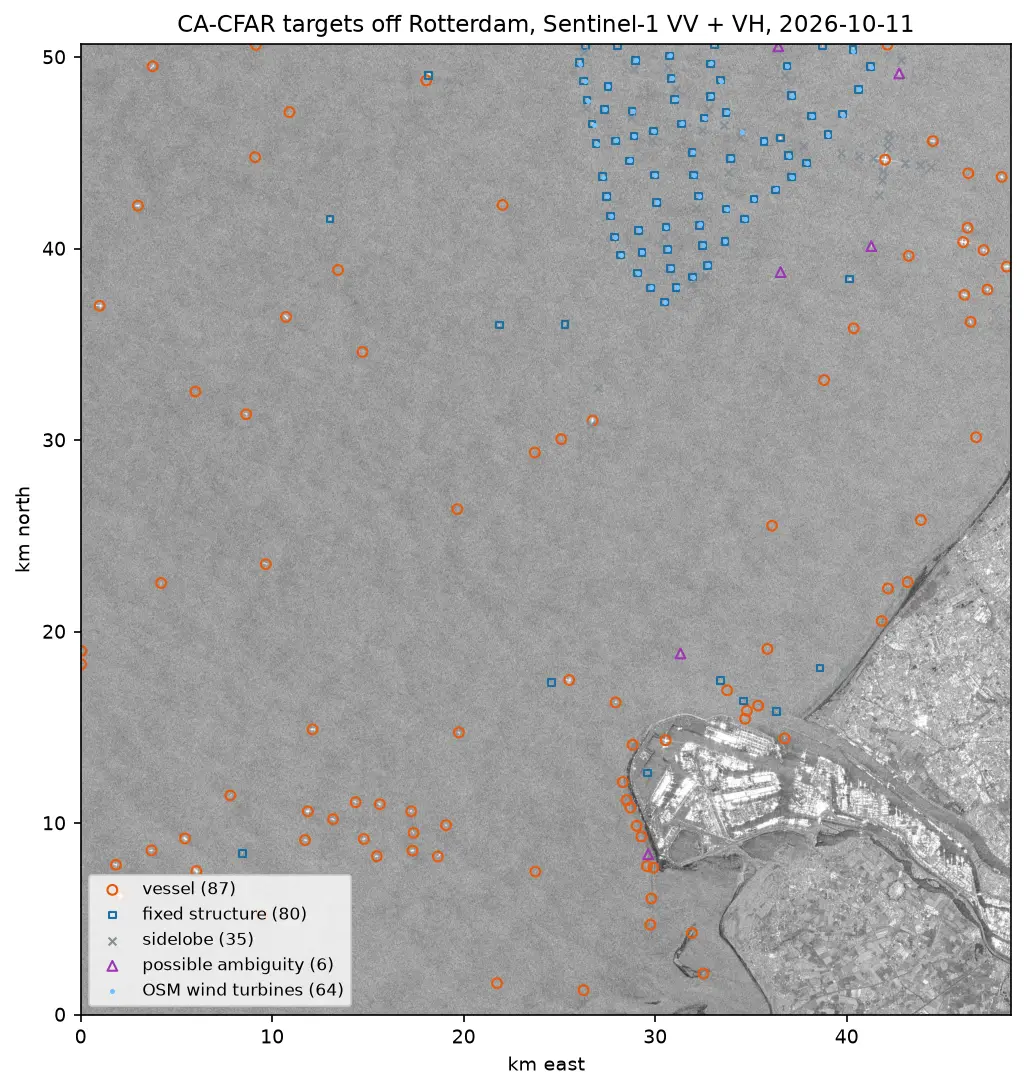
Detect ships in free Sentinel-1 SAR imagery with a cell-averaging CFAR detector written in NumPy and SciPy: mask the land, set a threshold from a speckle model, cluster detections into targets, reject wind turbines, sidelobes and ambiguities, compare VV with VH and export the vessels as GeoJSON.

Intermediate 16 min read

Tutorial Python

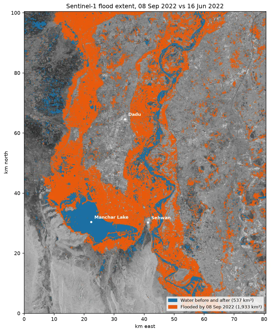
Sentinel-1 SAR flood mapping in Python: the 2022 Pakistan floods

Map the 2022 Sindh floods with free Sentinel-1 radar from the Microsoft Planetary Computer: convert backscatter to decibels, remove speckle with a Lee filter, pick a water threshold with Otsu's method, and measure the flood extent and how it receded over seven months.

Intermediate 10 min read