#Spatial cross-validation

3 posts

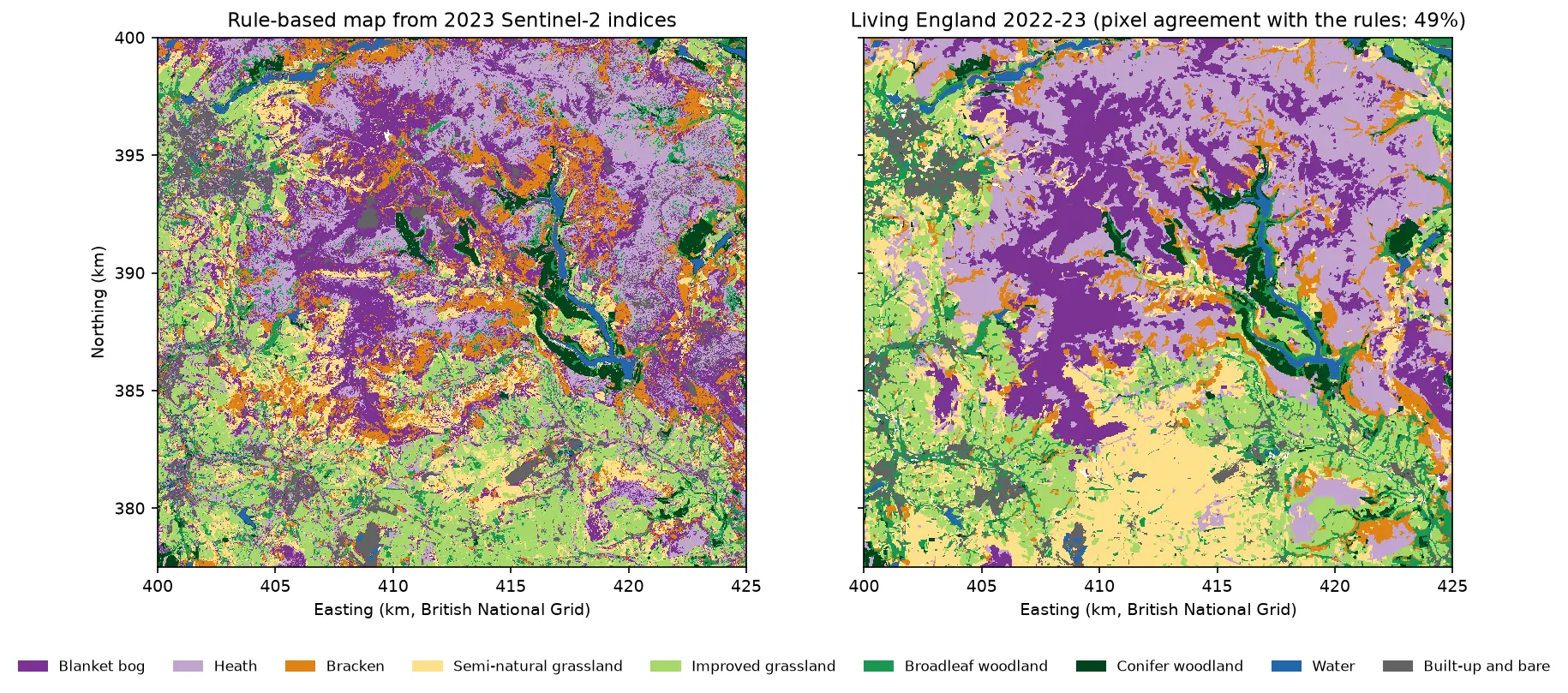
Two habitat maps of the Dark Peak side by side. Left: the rule-based map from Sentinel-2, with purple blanket bog and lilac heath on the Kinder and Bleaklow plateaux, orange bracken on the valley sides, green grassland and woodland in the valleys and blue reservoirs in the Derwent valley. Right: Living England 2022-23 for the same area, with smoother patches of the same classes.

Tutorial Python Part 1 of 5

Habitat mapping with Sentinel-2 in Python: spectral index rules and an honest accuracy assessment

Map blanket bog, heath, bracken, grassland, woodland, water and built-up land in the Peak District from 2023 Sentinel-2 seasonal composites with an eight-rule spectral index classifier, then assess it properly: a confusion matrix, user's and producer's accuracy, kappa and its caveats, block-bootstrap confidence intervals, and why a random train/test split overstates accuracy.
Beginner 19 min read

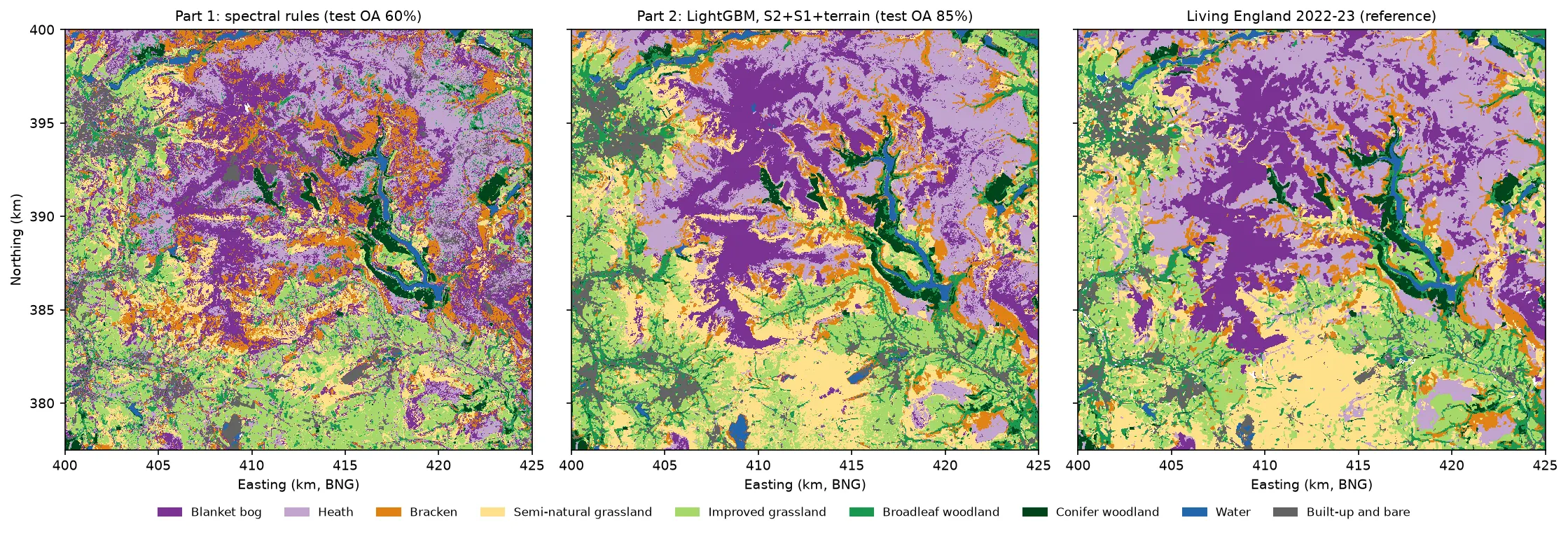
Three habitat maps of the Dark Peak side by side. Left: the noisy Part 1 rule-based map. Centre: the LightGBM map, with smooth purple blanket bog on the Kinder and Bleaklow plateaux, lilac heath around them, orange bracken on the valley sides, yellow semi-natural grassland in the south, green grassland and woodland in the valleys and blue reservoirs. Right: Living England 2022-23, which the LightGBM map closely resembles.

Tutorial Python Part 2 of 5

Habitat classification with LightGBM in Python: Sentinel-2, Sentinel-1 and terrain fusion

Classify nine upland habitats in the Peak District with LightGBM on 77 multi-temporal features: seasonal Sentinel-2 bands and indices, Sentinel-1 VV and VH backscatter and Copernicus DEM terrain. Tune with spatial-fold cross-validation and class weights, run an S2 / S2+S1 / S2+S1+terrain ablation, explain the model with TreeSHAP and permutation importance, and compare it with a random forest and the Part 1 rules on the same test blocks.

Intermediate 21 min read

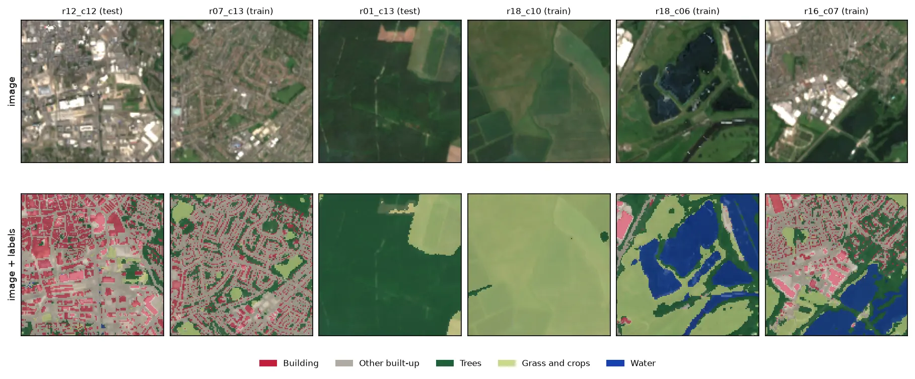
Six 128 by 128 pixel Sentinel-2 image chips of Nottingham, each shown above the same chip with its label mask overlaid: a city centre with red buildings and grey streets, a suburb, a forest, farmland, flooded gravel pits in blue and an industrial estate.

Tutorial Python Part 1 of 3

Training data for deep learning on satellite imagery: Sentinel-2 image chips in Python

Build a labelled deep learning dataset from free data: stream a Sentinel-2 L2A composite from the Planetary Computer, rasterise Overture building footprints over ESA WorldCover, cut georeferenced image chips, split them by spatial block so the test set does not leak, check the class balance and load it all as a TorchGeo dataset.

Intermediate 13 min read