#Variogram

2 posts

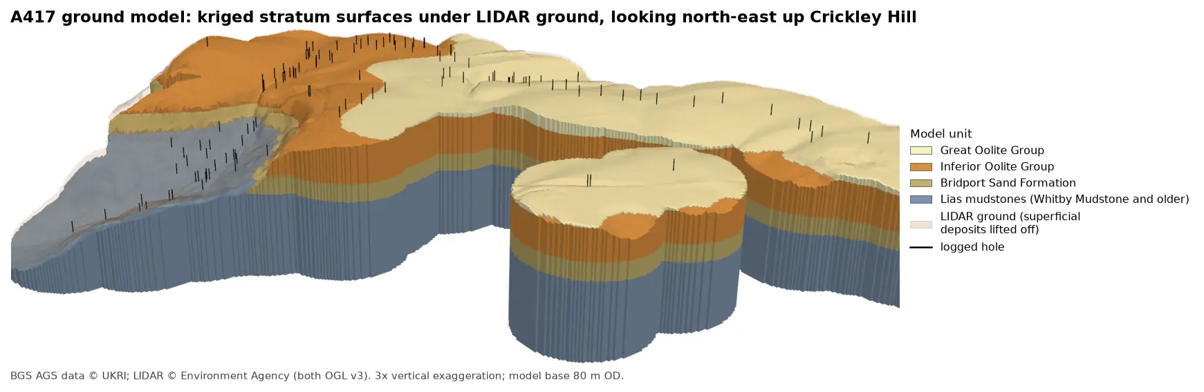
3D block model of the A417 ground model looking north-east up Crickley Hill: blue-grey Lias mudstones form the vale and the lower walls, under a band of olive Bridport Sand, a thick orange band of Inferior Oolite and pale yellow Great Oolite on the plateau. Black vertical lines mark the logged boreholes, and a faint buff skin shows the LIDAR ground lifted off the superficial deposits.

Tutorial Python Part 5 of 7

A 3D ground model from AGS4 boreholes: kriged stratum surfaces in Python

Pick rockhead and the top and base of the key formations from real AGS4 logs, krige them into stratum surfaces under Environment Agency LIDAR ground, and build a 3D ground model of the A417 escarpment in PyVista. Then test it: leave-one-out cross-validation at every borehole, kriging standard deviation maps, a check against every hole that stops short of a surface, and proof that no surface crosses another.
Advanced 15 min read

Tutorial Python Part 2 of 2

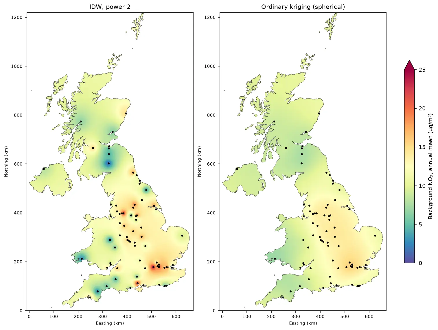
Kriging in Python with PyKrige: IDW vs ordinary kriging of UK NO₂ monitoring data

A practical spatial interpolation tutorial in Python: download real 2025 NO₂ annual means from the UK AURN network, fit spherical, exponential and Gaussian variograms, run ordinary kriging with PyKrige, compare it with inverse distance weighting, score both with leave-one-out cross-validation, map the kriging variance and add Sentinel-5P satellite NO₂ as a covariate.

Intermediate 16 min read