Ireland GIS data sources
- Region
- Northern Europe
- ISO 3166
- IE · IRL
- Sources
- 15
- Themes
- 14
- Last verified
Where to download GIS data for Ireland: 15 sources across 14 themes, led by Tailte Éireann and Geological Survey Ireland. 9 offer vector downloads such as Shapefile, GeoPackage or GeoJSON, 2 cover elevation including LiDAR. 11 are under an open licence. Every link was last checked on 18 Oct 2026.
- Ireland in the LiDAR & elevation atlas Partial open LiDAR
- Ireland in the aerial & satellite imagery atlas Restricted
National and OpenStreetMap sources for Ireland
Boundaries & admin 3
Administrative boundary data for every country-
Tailte Éireann Open Data (opens in a new tab)
Download Cost: FreeTailte Éireann
Administrative and statutory boundaries (formerly Ordnance Survey Ireland).
- Boundaries & admin
- Transport
Verified
-
GeoHive (opens in a new tab)
Portal Cost: FreeTailte Éireann
National mapping agency hub with open boundary and prime2 data.
- Boundaries & admin
- Imagery
Verified
-
geoBoundaries administrative boundaries (opens in a new tab)
API Cost: FreeWilliam & Mary geoLab
JSON API listing every available admin level with direct download links.
- Boundaries & admin
Verified
Elevation / DEM 1
Free DEM, LiDAR and elevation data for every country-
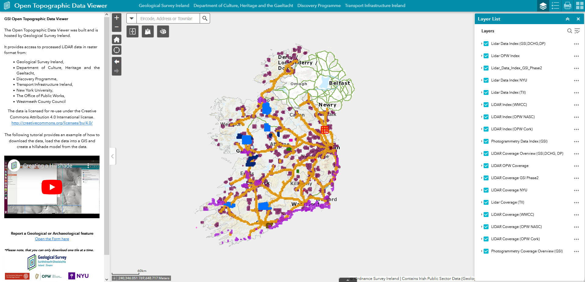
GSI Open Topographic Data Viewer (opens in a new tab)
Web viewer Cost: FreeGeological Survey Ireland
LiDAR, photogrammetry and DEMs.
- Elevation / DEM
- Imagery
Verified
Land cover 1
Land cover datasets for every country-
National Land Cover Map (opens in a new tab)
Download Cost: FreeTailte Éireann · Ireland
High-resolution national land cover map of Ireland produced with the EPA.
- Land cover
Verified
Population 1
Gridded population data for every country-
CSO Census 2022 Small Area Population Statistics (opens in a new tab)
Portal Cost: FreeCentral Statistics Office Ireland
Census 2022 results for Small Areas, Electoral Divisions and other geographies, with boundary files.
- Population
- Census & statistics
- Boundaries & admin
Verified
Transport 1
Road, rail and transport data for every country-
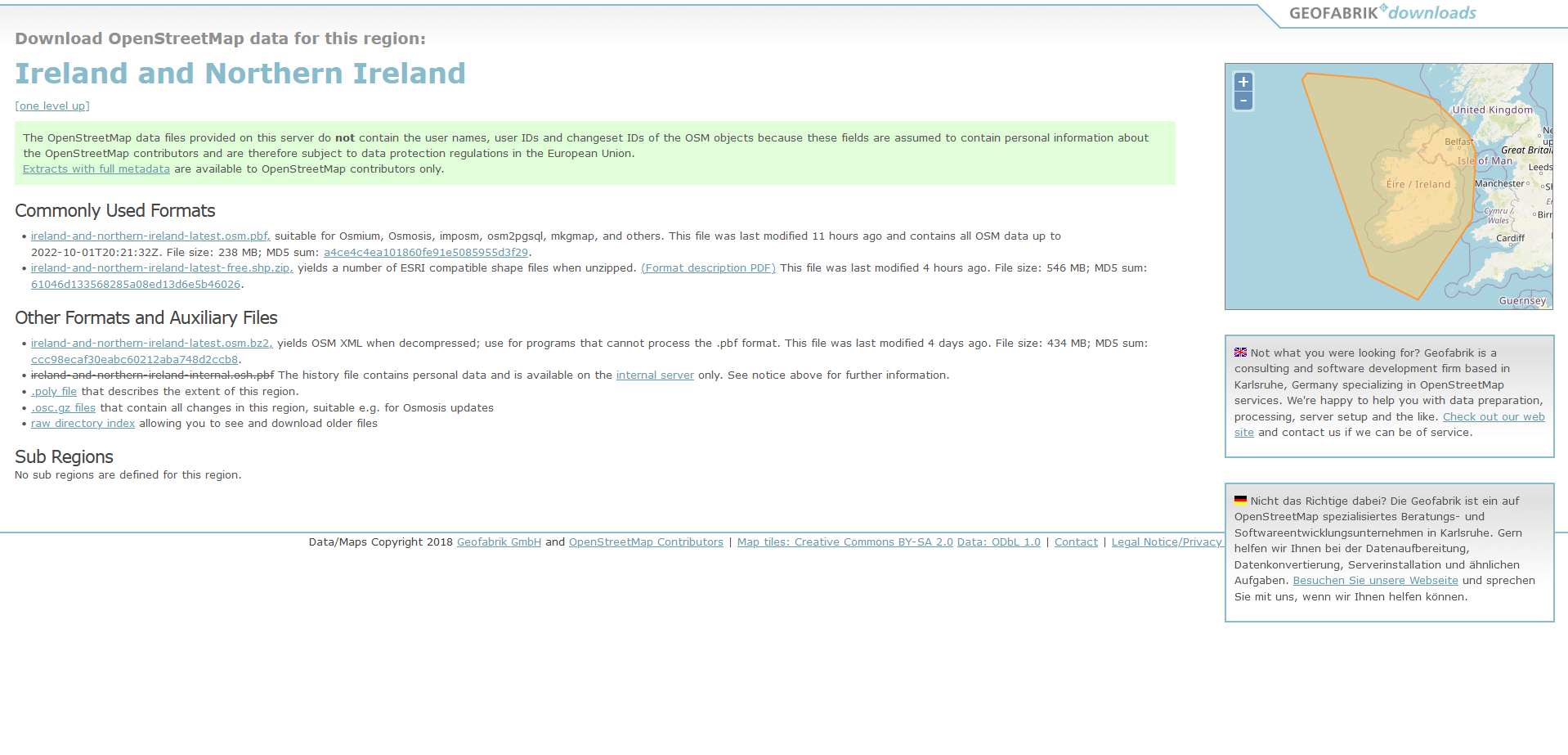
Geofabrik OpenStreetMap extract (Ireland and Northern Ireland) (opens in a new tab)
Download Cost: FreeGeofabrik / OpenStreetMap contributors · Island of Ireland
- Transport
- Boundaries & admin
Verified
Climate & weather 1
Climate and weather data for every country-
Met Éireann historical data (opens in a new tab)
Download Cost: FreeMet Éireann · Ireland
Hourly, daily and monthly records from Irish weather stations.
- Climate & weather
Verified
Natural hazards 1
Natural hazard data for every country-
floodinfo.ie (opens in a new tab)
Web viewer Cost: FreeOffice of Public Works · Ireland
National flood maps (CFRAM), past flood events and flood relief schemes.
- Natural hazards
- Hydrology
Verified
Geology 1
Geology data for every country-
Geological Survey Ireland (data and maps) (opens in a new tab)
Download Cost: FreeGeological Survey Ireland
- Geology
Verified
Marine & coastal 2
Marine, coastal and bathymetry data for every country-
INFOMAR seabed mapping data (opens in a new tab)
Download Cost: FreeGeological Survey Ireland / Marine Institute · Ireland waters
Multibeam bathymetry, backscatter and seabed sediment maps for Irish waters.
- Marine & coastal
- Elevation / DEM
Verified
-
Marine Institute data catalogue (opens in a new tab)
Portal Cost: FreeMarine Institute · Ireland waters
Ocean observations, fisheries and marine spatial datasets for Irish waters.
- Marine & coastal
Verified
Environment 2
Environmental and protected area data for every country-
EPA GIS data downloads (opens in a new tab)
Download Cost: FreeEnvironmental Protection Agency
Download page for EPA spatial datasets: water bodies, WFD status, CORINE, licensed facilities and more.
- Environment
- Hydrology
Verified
-
NPWS designated site boundary data (opens in a new tab)
Download Cost: FreeNational Parks and Wildlife Service · Ireland
Boundaries of SACs, SPAs, NHAs and national parks.
- Environment
Verified
Open data portal 1
Open geospatial data portals for every country-
data.gov.ie (opens in a new tab)
Portal Cost: FreeGovernment of Ireland
- Open data portal
Verified
Global datasets that cover Ireland
Worldwide and continental layers that include Ireland, useful where national data is missing, restricted or inconsistent across borders.
- Boundaries & admin
-
- Open Maps for Europe (EuroGlobalMap, EuroRegionalMap) (opens in a new tab) EuroGeographics · Open licence · Free · Verified
- Eurostat GISCO (opens in a new tab) European Commission (Eurostat) · Provider terms / varies · Free · Verified
- GADM (opens in a new tab) GADM project · Non-commercial only · Free · Verified
- Elevation / DEM
-
- ALOS World 3D 30 m (AW3D30) (opens in a new tab) JAXA · Open licence · Free with registration · Verified
- Copernicus DEM (GLO-30 / GLO-90) (opens in a new tab) ESA / Airbus (Copernicus) · Open licence · Free · Verified
- ETOPO 2022 Global Relief Model (opens in a new tab) NOAA NCEI · Open licence · Free · Verified
- Imagery
-
- AlphaEarth Foundations Satellite Embeddings (annual, COG mirror) (opens in a new tab) Google and Google DeepMind (mirror by Taylor Geospatial on Source Cooperative) · Open licence · Free · Verified
- ASF Data Search (Vertex) (opens in a new tab) Alaska Satellite Facility · Provider terms / varies · Free with registration · Verified
- Copernicus Data Space Ecosystem (opens in a new tab) European Space Agency / European Commission · Open licence · Free with registration · Verified
- Land cover
-
- Copernicus Land Monitoring Service (opens in a new tab) European Environment Agency · Open licence · Free with registration · Verified
- LUCAS Land Use and Coverage Area frame Survey (opens in a new tab) European Commission (Eurostat) · Provider terms / varies · Free · Verified
- Copernicus Global Dynamic Land Cover (CGLS-LC100) (opens in a new tab) Copernicus Land Monitoring Service · Open licence · Free with registration · Verified
- Buildings
-
- Microsoft Global ML Building Footprints (opens in a new tab) Microsoft · Open licence · Free · Verified
- Population
-
- Global Human Settlement Layer (opens in a new tab) European Commission JRC · Open licence · Free · Verified
- Gridded Population of the World (GPWv4) (opens in a new tab) CIESIN, Columbia University / NASA SEDAC · Open licence · Free with registration · Verified
- Kontur Population (opens in a new tab) Kontur · Open licence · Free · Verified
- Census & statistics
-
- UNdata (opens in a new tab) UN Statistics Division · Open licence · Free · Verified
- World Bank Open Data (opens in a new tab) World Bank · Open licence · Free · Verified
- Transport
-
- BBBike custom OSM extracts (opens in a new tab) BBBike.org · Open licence · Free · Verified
- Geofabrik downloads (opens in a new tab) Geofabrik · Open licence · Free · Verified
- GRIP global roads database (opens in a new tab) PBL Netherlands Environmental Assessment Agency (GLOBIO) · Open licence · Free · Verified
- Hydrology
-
- Global Flood Awareness System (GloFAS) (opens in a new tab) Copernicus Emergency Management Service / ECMWF · Open licence · Free · Verified
- Global Runoff Data Centre (GRDC) (opens in a new tab) Federal Institute of Hydrology (BfG), Germany / WMO · Provider terms / varies · Free · Verified
- HydroBASINS (opens in a new tab) WWF / McGill University (HydroSHEDS) · Open licence · Free · Verified
- Climate & weather
-
- ARCO-ERA5 (analysis-ready, cloud-optimised ERA5) (opens in a new tab) Google Research · Open licence · Free · Verified
- CHELSA climatologies (opens in a new tab) Swiss Federal Research Institute WSL · Open licence · Free · Verified
- Copernicus Atmosphere Data Store (CAMS) (opens in a new tab) ECMWF / Copernicus Atmosphere Monitoring Service · Open licence · Free with registration · Verified
- Natural hazards
-
- Aqueduct Floods Hazard Maps (opens in a new tab) World Resources Institute · Open licence · Free · Verified
- Copernicus Emergency Management Service: rapid mapping (opens in a new tab) European Commission (Copernicus EMS) · Open licence · Free · Verified
- EM-DAT international disaster database (opens in a new tab) CRED, UCLouvain · Non-commercial only · Free · Verified
- Geology
-
- Macrostrat (opens in a new tab) University of Wisconsin–Madison · Open licence · Free · Verified
- OneGeology Portal (opens in a new tab) OneGeology · Provider terms / varies · Free · Verified
- Marine & coastal
-
- EMODnet (European Marine Observation and Data Network) (opens in a new tab) European Commission (DG MARE) · Open licence · Free · Verified
- Copernicus Marine Service (opens in a new tab) Mercator Ocean International (Copernicus) · Open licence · Free with registration · Verified
- Global Fishing Watch datasets (opens in a new tab) Global Fishing Watch · Non-commercial only · Free with registration · Verified
- Environment
-
- EEA Datahub (opens in a new tab) European Environment Agency · Open licence · Free · Verified
- GBIF occurrence API (opens in a new tab) Global Biodiversity Information Facility · Provider terms / varies · Free with registration · Verified
- Key Biodiversity Areas (opens in a new tab) KBA Partnership / BirdLife International · Non-commercial only · Free with registration · Verified
- Open data portal
-
- data.europa.eu (opens in a new tab) Publications Office of the EU · Provider terms / varies · Free · Verified
- Registry of Open Data on AWS (opens in a new tab) Amazon Web Services · Provider terms / varies · Free · Verified
- Humanitarian Data Exchange (opens in a new tab) UN OCHA · Provider terms / varies · Free · Verified
Tutorials that use this kind of data
- Getting started with GeoPandas: projections, spatial joins and choropleth maps Beginner
- Terrain analysis in Python: stream, clip and analyse a DEM with rasterio and rioxarray Intermediate
- Measuring Lake Mead's shrinking shoreline with Sentinel-2, STAC and Python Intermediate
- Land cover classification in Python: a Sentinel-2 random forest with scikit-learn Intermediate
From our original guide
Neighbouring countries
- United Kingdom GIS data 70 sources · shares a border
- Isle of Man GIS data 5 sources
- Guernsey GIS data 5 sources
- Jersey GIS data 4 sources