United Kingdom GIS data sources
- Region
- Northern Europe
- ISO 3166
- GB · GBR
- Sources
- 70
- Themes
- 17
- Last verified
Where to download GIS data for United Kingdom: 70 sources across 17 themes, led by Ordnance Survey and Environment Agency. 35 offer vector downloads such as Shapefile, GeoPackage or GeoJSON, 10 cover elevation including LiDAR. 57 are under an open licence. Every link was last checked on 15 Nov 2026.
- United Kingdom in the LiDAR & elevation atlas National open LiDAR
- United Kingdom in the aerial & satellite imagery atlas Partial open imagery
National and OpenStreetMap sources for United Kingdom
Boundaries & admin 12
Administrative boundary data for every country-
Spatial Hub Scotland (opens in a new tab)
Portal Cost: Free with registrationImprovement Service · Scotland
Local-authority spatial data for Scotland.
- Boundaries & admin
- Transport
- Environment
Verified
-
Open Geography Portal (opens in a new tab)
API Cost: FreeOffice for National Statistics
Census and administrative boundaries, lookups and postcode directories.
- Boundaries & admin
- Census & statistics
Verified
-
OS Data Hub (opens in a new tab)
API Cost: MixedOrdnance Survey
OS OpenData downloads (Boundary-Line, Terrain 50, Open Roads, Open Rivers) and OS APIs.
- Boundaries & admin
- Elevation / DEM
- Transport
- Hydrology
Verified
-
OS Open Zoomstack (opens in a new tab)
Download Cost: FreeOrdnance Survey · Great Britain
Single open vector basemap of Great Britain from national to street level, supplied as GeoPackage or vector tiles.
- Boundaries & admin
- Transport
- Buildings
- Hydrology
Verified
-
OS Boundary-Line (opens in a new tab)
Download Cost: FreeOrdnance Survey · Great Britain
Electoral and administrative boundaries for Great Britain: counties, districts, wards, parishes and constituencies.
- Boundaries & admin
Verified
-
OS Code-Point Open (opens in a new tab)
Download Cost: FreeOrdnance Survey · Great Britain
Point location for every postcode unit in Great Britain, with admin area codes.
- Boundaries & admin
- Census & statistics
Verified
-
OS Open Names (opens in a new tab)
Download Cost: FreeOrdnance Survey · Great Britain
Gazetteer of place names, roads and postcodes in Great Britain, useful for geocoding.
- Boundaries & admin
Verified
-
OSNI Open Data (opens in a new tab)
Download Cost: FreeOrdnance Survey of Northern Ireland · Northern Ireland
OSNI open boundaries, 50 m DTM, gazetteer and largescale basemap layers.
- Boundaries & admin
- Elevation / DEM
- Transport
Verified
-
NISRA geography (opens in a new tab)
Download Cost: FreeNorthern Ireland Statistics and Research Agency · Northern Ireland
Data zones, super data zones and other statistical geographies for Northern Ireland.
- Boundaries & admin
- Census & statistics
Verified
-
postcodes.io (opens in a new tab)
API Cost: FreeIdeal Postcodes · United Kingdom
Free UK postcode lookup and geocoding API with no key needed: bulk lookups of up to 100 postcodes return coordinates, Output Area, LSOA, MSOA, ward and local authority codes.
- Boundaries & admin
- Census & statistics
Verified
-
ONS geographical products (opens in a new tab)
Portal Cost: FreeOffice for National Statistics
Guide to ONS statistical geographies, lookups and boundary products; the files themselves are published on the Open Geography Portal.
- Boundaries & admin
- Census & statistics
Verified
-
geoBoundaries administrative boundaries (opens in a new tab)
API Cost: FreeWilliam & Mary geoLab
JSON API listing every available admin level with direct download links.
- Boundaries & admin
Verified
Elevation / DEM 6
Free DEM, LiDAR and elevation data for every country-
Scottish Remote Sensing Portal (opens in a new tab)
Download Cost: FreeScottish Government · Scotland
Public-sector LiDAR and aerial photography for Scotland.
- Elevation / DEM
- Imagery
Verified
-
Defra Survey Data Download (LiDAR and survey data) (opens in a new tab)
Download Cost: FreeDepartment for Environment, Food & Rural Affairs · England
Tile-based download of Environment Agency LiDAR DTM/DSM, point clouds, and other survey data for England.
- Elevation / DEM
- Imagery
Verified
-
OS Terrain 50 (opens in a new tab)
Download Cost: FreeOrdnance Survey · Great Britain
50 m digital terrain model and 10 m contours for Great Britain.
- Elevation / DEM
Verified
-
Environment Agency National LIDAR Programme (opens in a new tab)
Download Cost: FreeEnvironment Agency · England
Complete 1 m LiDAR coverage of England flown 2016-2022: DTM, first-return DSM, intensity and point cloud.
- Elevation / DEM
Verified
-
LIDAR Composite DTM 1 m (opens in a new tab)
Download Cost: FreeEnvironment Agency · England
Seamless 1 m bare-earth terrain model of England composited from all EA LiDAR surveys.
- Elevation / DEM
Verified
-
LIDAR Composite First Return DSM 1 m (opens in a new tab)
Download Cost: FreeEnvironment Agency · England
Seamless 1 m first-return surface model of about 99% of England (2022), including trees and buildings; subtract the composite DTM for a canopy or building height model.
- Elevation / DEM
- Environment
Verified
-
Defra and JNCC Sentinel-2 Analysis Ready Data (opens in a new tab)
Download Cost: FreeDefra / JNCC · England
Copernicus Sentinel-2 imagery processed to atmospherically corrected, cloud-masked analysis-ready surface reflectance for England.
- Imagery
Verified
Land cover 2
Land cover datasets for every country-
UKCEH Land Cover Maps (opens in a new tab)
Download Cost: MixedUK Centre for Ecology & Hydrology
- Land cover
Verified
-
Living England Habitat Map (Phase 4) (opens in a new tab)
Download Cost: FreeNatural England · England
Broad habitat map of England classified from Copernicus Sentinel-1 and Sentinel-2 imagery.
- Land cover
- Environment
Verified
Buildings 2
Building footprint data for every country-
OS Open UPRN (opens in a new tab)
Download Cost: FreeOrdnance Survey · Great Britain
Coordinates for every Unique Property Reference Number (UPRN) in Great Britain; the open key for linking address-level data.
- Buildings
- Addresses & cadastre
Verified
-
OS OpenMap - Local (opens in a new tab)
Download Cost: FreeOrdnance Survey · Great Britain
Detailed open street-level vector map including building footprints, roads, water and named places.
- Buildings
- Transport
- Hydrology
Verified
Population 2
Gridded population data for every country-
Scotland's Census (opens in a new tab)
Portal Cost: FreeNational Records of Scotland · Scotland
Census results and output-area geographies for Scotland.
- Population
- Census & statistics
- Boundaries & admin
Verified
-
Census 2021 interactive maps (opens in a new tab)
Web viewer Cost: FreeOffice for National Statistics · England and Wales
Census 2021 results mapped down to output area.
- Population
- Census & statistics
Verified
Census & statistics 5
Census and statistics data for every country-
Nomis (opens in a new tab)
API Cost: FreeOffice for National Statistics
Census 2021 and labour-market statistics by small area.
- Census & statistics
Verified
-
Get Information about Schools (GIAS) (opens in a new tab)
Download Cost: FreeDepartment for Education · England
The register of every school, academy, college and nursery school in England, updated daily: address, postcode, type, phase, pupil numbers and a British National Grid easting and northing for each establishment.
- Census & statistics
- Population
Verified
-
Patients Registered at a GP Practice (opens in a new tab)
Download Cost: FreeNHS England Digital · England
Monthly counts of patients registered at every GP practice in England by sex and age, with a practice-to-postcode and ICB mapping file; geocode the practices by postcode to map demand and supply.
- Census & statistics
- Population
Verified
-
General Practice Workforce (opens in a new tab)
Download Cost: FreeNHS England Digital · England
Monthly headcount and full-time equivalent (FTE) GPs, nurses and other staff at each GP practice in England, the supply side for healthcare accessibility measures such as 2SFCA.
- Census & statistics
Verified
-
Median house prices by MSOA (house price statistics for small areas) (opens in a new tab)
Download Cost: FreeOffice for National Statistics · England and Wales
Median price paid for residential property in every Middle layer Super Output Area, for rolling years from 1995, by property type and for new and existing dwellings, derived from HM Land Registry Price Paid Data (formerly HPSSA dataset 2).
- Census & statistics
Verified
Addresses & cadastre 2
Address and cadastral data for every country-
INSPIRE Index Polygons (opens in a new tab)
Download Cost: FreeHM Land Registry · England & Wales
Freehold title extents for England and Wales.
- Addresses & cadastre
Verified
-
Planning Data (opens in a new tab)
API Cost: FreeMinistry of Housing, Communities and Local Government · England
National planning datasets: conservation areas, listed buildings, Article 4 directions, tree preservation zones and more.
- Addresses & cadastre
- Boundaries & admin
Verified
Transport 8
Road, rail and transport data for every country-
Geofabrik OpenStreetMap extract (Wales) (opens in a new tab)
Download Cost: FreeGeofabrik / OpenStreetMap contributors · Wales
- Transport
- Boundaries & admin
Verified
-
Geofabrik OpenStreetMap extract (Scotland) (opens in a new tab)
Download Cost: FreeGeofabrik / OpenStreetMap contributors · Scotland
- Transport
- Boundaries & admin
Verified
-
Geofabrik OpenStreetMap extract (England) (opens in a new tab)
Download Cost: FreeGeofabrik / OpenStreetMap contributors · England
- Transport
- Boundaries & admin
Verified
-
OS Open Roads (opens in a new tab)
Download Cost: FreeOrdnance Survey · Great Britain
Connected road network for Great Britain with road classification and names, suitable for routing.
- Transport
Verified
-
Road traffic statistics (opens in a new tab)
Download Cost: FreeDepartment for Transport · Great Britain
Annual average daily traffic flows at count points on the GB road network.
- Transport
- Census & statistics
Verified
-
NaPTAN public transport access nodes (opens in a new tab)
Download Cost: FreeDepartment for Transport · Great Britain
Locations of every bus stop, rail station and other public transport access point.
- Transport
Verified
-
Bus Open Data Service (opens in a new tab)
API Cost: FreeDepartment for Transport · England
Bus timetables, fares and live vehicle locations for operators in England.
- Transport
Verified
-
OpenStreetMap extract – United Kingdom (opens in a new tab)
Download Cost: FreeGeofabrik / OpenStreetMap contributors
Daily OSM extract.
- Transport
- Boundaries & admin
- Hydrology
Verified
Hydrology 5
River, lake and hydrology data for every country-
OS Open Rivers (opens in a new tab)
Download Cost: FreeOrdnance Survey · Great Britain
Generalised, connected watercourse network for Great Britain with flow direction and names.
- Hydrology
Verified
-
Real-time flood monitoring API (opens in a new tab)
API Cost: FreeEnvironment Agency · England
Live flood warnings and river level, flow, rainfall and tide readings from EA monitoring stations, updated every 15 minutes.
- Hydrology
- Natural hazards
Verified
-
Hydrology Data Explorer (opens in a new tab)
API Cost: FreeEnvironment Agency · England
Archive of quality-checked river flow, level, rainfall and groundwater readings with a REST API.
- Hydrology
Verified
-
Catchment Data Explorer (opens in a new tab)
Web viewer Cost: FreeEnvironment Agency · England
Water Framework Directive water bodies, catchments and classification results.
- Hydrology
- Environment
Verified
-
National River Flow Archive (opens in a new tab)
API Cost: FreeUK Centre for Ecology & Hydrology · United Kingdom
River flow records and catchment boundaries for some 1600 UK gauging stations.
- Hydrology
Verified
Climate & weather 3
Climate and weather data for every country-
HadUK-Grid gridded climate observations (opens in a new tab)
Download Cost: FreeMet Office · United Kingdom
Daily, monthly and annual temperature, rainfall and other variables on 1 km to 60 km grids from 1836 onwards.
- Climate & weather
Verified
-
HadUK-Grid on the CEDA Archive (opens in a new tab)
Download Cost: Free with registrationMet Office / CEDA · United Kingdom
Download location for the HadUK-Grid NetCDF files (free CEDA account required).
- Climate & weather
Verified
-
Met Office Climate Data Portal (opens in a new tab)
Portal Cost: FreeMet Office · United Kingdom
UKCP18 climate projections and observed climate indicators as GIS-ready layers.
- Climate & weather
Verified
Natural hazards 3
Natural hazard data for every country-
Flood Map for Planning: Flood Zones (opens in a new tab)
Download Cost: FreeEnvironment Agency · England
Flood Zones 2 and 3 for rivers and the sea, as used in planning decisions.
- Natural hazards
- Hydrology
Verified
-
Risk of Flooding from Surface Water (opens in a new tab)
Download Cost: FreeEnvironment Agency · England
National surface-water (pluvial) flood extents and depths for a range of likelihoods.
- Natural hazards
- Hydrology
Verified
-
SEPA flood maps (opens in a new tab)
Web viewer Cost: FreeScottish Environment Protection Agency · Scotland
River, coastal and surface-water flood hazard maps for Scotland.
- Natural hazards
- Hydrology
Verified
Geology 5
Geology data for every country-
BGS GeoIndex (opens in a new tab)
Web viewer Cost: FreeBritish Geological Survey
Onshore geology, boreholes and hazards.
- Geology
Verified
-
BGS Geology 625k (DiGMapGB-625) (opens in a new tab)
Download Cost: FreeBritish Geological Survey · United Kingdom
Free 1:625 000 bedrock and superficial geology of the UK.
- Geology
Verified
-
BGS Geology 50k (DiGMapGB-50) (opens in a new tab)
Download Cost: MixedBritish Geological Survey · Great Britain
Detailed 1:50 000 bedrock, superficial, mass-movement and artificial ground geology; free view service, licensed download.
- Geology
Verified
-
BGS OpenGeoscience (opens in a new tab)
Portal Cost: FreeBritish Geological Survey · United Kingdom
Free BGS maps, borehole scans, photographs and web services.
- Geology
Verified
-
British Geological Survey · Great Britain
Ground investigation data donated in AGS format: borehole locations, logs, samples and test results, with an OGC API index of holes.
- Geology
Verified
Agriculture & soils 2
Agriculture and soil data for every country-
Provisional Agricultural Land Classification (ALC) (opens in a new tab)
Download Cost: FreeNatural England · England
Grades 1-5 of agricultural land quality across England.
- Agriculture & soils
Verified
-
Crop Map of England (CROME) 2023 (opens in a new tab)
Download Cost: FreeRural Payments Agency · England
Annual hexagon-based crop type classification of England derived from Sentinel-1 and Sentinel-2 imagery.
- Agriculture & soils
- Land cover
Verified
Marine & coastal 2
Marine, coastal and bathymetry data for every country-
ADMIRALTY Marine Data Portal (opens in a new tab)
Portal Cost: FreeUK Hydrographic Office · United Kingdom waters
Free UKHO bathymetric survey data and seabed mapping in UK waters.
- Marine & coastal
- Elevation / DEM
Verified
-
MEDIN Portal (opens in a new tab)
Portal Cost: FreeMarine Environmental Data and Information Network · United Kingdom waters
Catalogue of UK marine data from government, research and industry.
- Marine & coastal
Verified
Environment 5
Environmental and protected area data for every country-
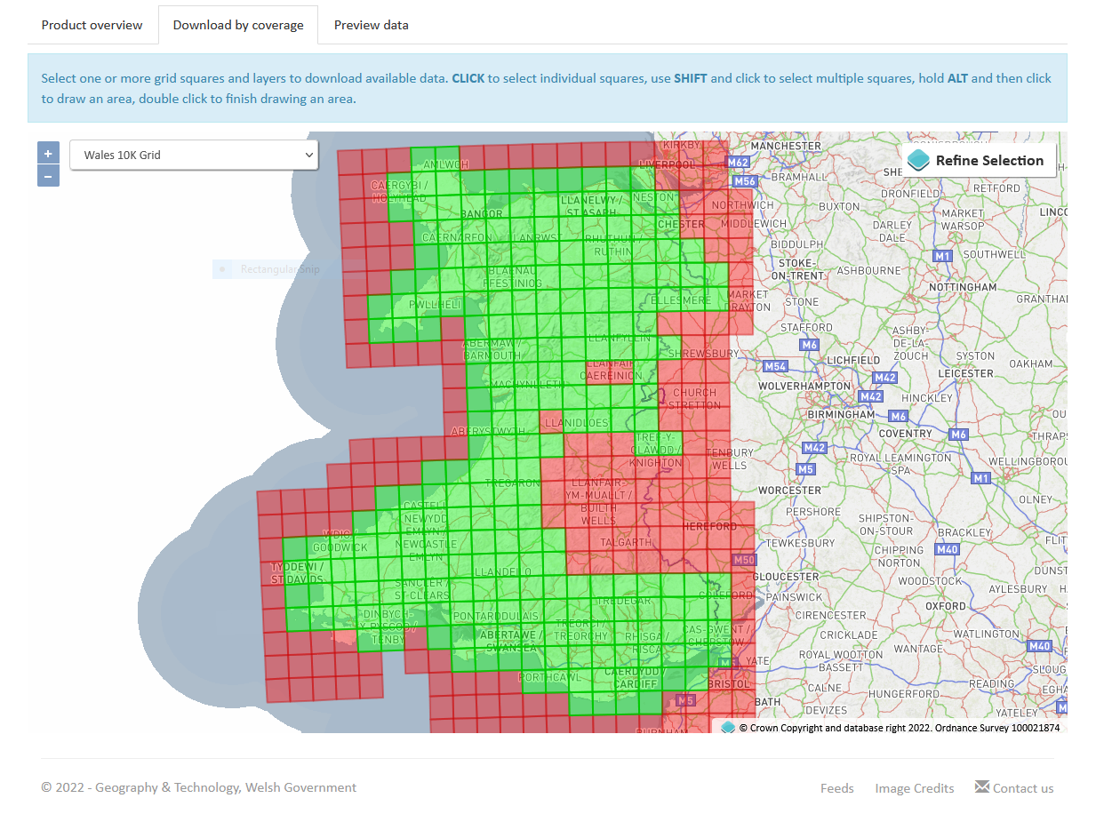
DataMapWales (formerly Lle Geo-Portal) (opens in a new tab)
Portal Cost: FreeWelsh Government & Natural Resources Wales · Wales
Geo-portal for Wales: LiDAR, environmental designations and planning data. Replaces the decommissioned Lle Geo-Portal.
- Environment
- Elevation / DEM
- Land cover
Verified
-
Defra UK-AIR (Air Information Resource) (opens in a new tab)
Download Cost: FreeDepartment for Environment, Food & Rural Affairs · United Kingdom
Hourly and annual measurements from the Automatic Urban and Rural Network (AURN) and other UK air quality networks: NO2, PM2.5, PM10, ozone and more, with site coordinates and modelled background maps.
- Environment
- Climate & weather
Verified
-
Natural England Open Data Geoportal (opens in a new tab)
Portal Cost: FreeNatural England · England
Designated sites (SSSI, SAC, SPA, National Parks, AONB), priority habitats, ancient woodland and access land.
- Environment
- Land cover
Verified
-
NatureScot Open Data (opens in a new tab)
Portal Cost: FreeNatureScot · Scotland
Protected areas, habitats and landscape datasets for Scotland.
- Environment
Verified
-
Trees In Camden (opens in a new tab)
API Cost: FreeLondon Borough of Camden · London Borough of Camden
Point locations of about 28,000 council-owned trees on Camden's highways, parks and open spaces, with species, height, spread, trunk diameter and maturity; downloadable or queryable through the Socrata API.
- Environment
Verified
Open data portal 5
Open geospatial data portals for every country-
OpenDataNI (opens in a new tab)
Portal Cost: FreeNorthern Ireland Executive · Northern Ireland
Open data for Northern Ireland, including OSNI open boundaries.
- Open data portal
Verified
-
data.gov.uk (opens in a new tab)
Portal Cost: FreeUK Government
National open data catalogue.
- Open data portal
Verified
-
Defra Data Services Platform (opens in a new tab)
Portal Cost: FreeDepartment for Environment, Food & Rural Affairs · England
Single catalogue and download point for Defra group spatial data (Environment Agency, Natural England, RPA and others).
- Open data portal
- Environment
- Hydrology
Verified
-
Scotland's spatial data catalogue (opens in a new tab)
Portal Cost: FreeScottish Government · Scotland
INSPIRE metadata catalogue for Scottish public-sector spatial datasets and services.
- Open data portal
Verified
-
SpatialNI (opens in a new tab)
Portal Cost: MixedLand & Property Services (Northern Ireland) · Northern Ireland
Northern Ireland spatial data infrastructure and INSPIRE catalogue.
- Open data portal
Verified
Global datasets that cover United Kingdom
Worldwide and continental layers that include United Kingdom, useful where national data is missing, restricted or inconsistent across borders.
- Boundaries & admin
-
- Open Maps for Europe (EuroGlobalMap, EuroRegionalMap) (opens in a new tab) EuroGeographics · Open licence · Free · Verified
- Eurostat GISCO (opens in a new tab) European Commission (Eurostat) · Provider terms / varies · Free · Verified
- GADM (opens in a new tab) GADM project · Non-commercial only · Free · Verified
- Elevation / DEM
-
- ALOS World 3D 30 m (AW3D30) (opens in a new tab) JAXA · Open licence · Free with registration · Verified
- Copernicus DEM (GLO-30 / GLO-90) (opens in a new tab) ESA / Airbus (Copernicus) · Open licence · Free · Verified
- ETOPO 2022 Global Relief Model (opens in a new tab) NOAA NCEI · Open licence · Free · Verified
- Imagery
-
- AlphaEarth Foundations Satellite Embeddings (annual, COG mirror) (opens in a new tab) Google and Google DeepMind (mirror by Taylor Geospatial on Source Cooperative) · Open licence · Free · Verified
- ASF Data Search (Vertex) (opens in a new tab) Alaska Satellite Facility · Provider terms / varies · Free with registration · Verified
- Copernicus Data Space Ecosystem (opens in a new tab) European Space Agency / European Commission · Open licence · Free with registration · Verified
- Land cover
-
- Copernicus Land Monitoring Service (opens in a new tab) European Environment Agency · Open licence · Free with registration · Verified
- LUCAS Land Use and Coverage Area frame Survey (opens in a new tab) European Commission (Eurostat) · Provider terms / varies · Free · Verified
- Copernicus Global Dynamic Land Cover (CGLS-LC100) (opens in a new tab) Copernicus Land Monitoring Service · Open licence · Free with registration · Verified
- Buildings
-
- Microsoft Global ML Building Footprints (opens in a new tab) Microsoft · Open licence · Free · Verified
- Population
-
- Global Human Settlement Layer (opens in a new tab) European Commission JRC · Open licence · Free · Verified
- Gridded Population of the World (GPWv4) (opens in a new tab) CIESIN, Columbia University / NASA SEDAC · Open licence · Free with registration · Verified
- Kontur Population (opens in a new tab) Kontur · Open licence · Free · Verified
- Census & statistics
-
- UNdata (opens in a new tab) UN Statistics Division · Open licence · Free · Verified
- World Bank Open Data (opens in a new tab) World Bank · Open licence · Free · Verified
- Addresses & cadastre
-
- OpenAddresses (opens in a new tab) OpenAddresses · Provider terms / varies · Free with registration · Verified
- Transport
-
- BBBike custom OSM extracts (opens in a new tab) BBBike.org · Open licence · Free · Verified
- Geofabrik downloads (opens in a new tab) Geofabrik · Open licence · Free · Verified
- GRIP global roads database (opens in a new tab) PBL Netherlands Environmental Assessment Agency (GLOBIO) · Open licence · Free · Verified
- Hydrology
-
- Global Flood Awareness System (GloFAS) (opens in a new tab) Copernicus Emergency Management Service / ECMWF · Open licence · Free · Verified
- Global Runoff Data Centre (GRDC) (opens in a new tab) Federal Institute of Hydrology (BfG), Germany / WMO · Provider terms / varies · Free · Verified
- HydroBASINS (opens in a new tab) WWF / McGill University (HydroSHEDS) · Open licence · Free · Verified
- Climate & weather
-
- ARCO-ERA5 (analysis-ready, cloud-optimised ERA5) (opens in a new tab) Google Research · Open licence · Free · Verified
- CHELSA climatologies (opens in a new tab) Swiss Federal Research Institute WSL · Open licence · Free · Verified
- Copernicus Atmosphere Data Store (CAMS) (opens in a new tab) ECMWF / Copernicus Atmosphere Monitoring Service · Open licence · Free with registration · Verified
- Natural hazards
-
- Aqueduct Floods Hazard Maps (opens in a new tab) World Resources Institute · Open licence · Free · Verified
- Copernicus Emergency Management Service: rapid mapping (opens in a new tab) European Commission (Copernicus EMS) · Open licence · Free · Verified
- EM-DAT international disaster database (opens in a new tab) CRED, UCLouvain · Non-commercial only · Free · Verified
- Geology
-
- Macrostrat (opens in a new tab) University of Wisconsin–Madison · Open licence · Free · Verified
- OneGeology Portal (opens in a new tab) OneGeology · Provider terms / varies · Free · Verified
- Agriculture & soils
-
- FAO Hand-in-Hand Geospatial Platform (opens in a new tab) Food and Agriculture Organization of the UN · Provider terms / varies · Free · Verified
- FAOSTAT (opens in a new tab) Food and Agriculture Organization of the UN · Open licence · Free · Verified
- GAEZ v4 (Global Agro-Ecological Zones) (opens in a new tab) FAO / IIASA · Non-commercial only · Free · Verified
- Marine & coastal
-
- EMODnet (European Marine Observation and Data Network) (opens in a new tab) European Commission (DG MARE) · Open licence · Free · Verified
- Copernicus Marine Service (opens in a new tab) Mercator Ocean International (Copernicus) · Open licence · Free with registration · Verified
- Global Fishing Watch datasets (opens in a new tab) Global Fishing Watch · Non-commercial only · Free with registration · Verified
- Environment
-
- EEA Datahub (opens in a new tab) European Environment Agency · Open licence · Free · Verified
- GBIF occurrence API (opens in a new tab) Global Biodiversity Information Facility · Provider terms / varies · Free with registration · Verified
- Key Biodiversity Areas (opens in a new tab) KBA Partnership / BirdLife International · Non-commercial only · Free with registration · Verified
- Open data portal
-
- data.europa.eu (opens in a new tab) Publications Office of the EU · Provider terms / varies · Free · Verified
- Registry of Open Data on AWS (opens in a new tab) Amazon Web Services · Provider terms / varies · Free · Verified
- Humanitarian Data Exchange (opens in a new tab) UN OCHA · Provider terms / varies · Free · Verified
Tutorials that use this kind of data
- Getting started with GeoPandas: projections, spatial joins and choropleth maps Beginner
- Terrain analysis in Python: stream, clip and analyse a DEM with rasterio and rioxarray Intermediate
- Measuring Lake Mead's shrinking shoreline with Sentinel-2, STAC and Python Intermediate
- Land cover classification in Python: a Sentinel-2 random forest with scikit-learn Intermediate
From our original guide
Neighbouring countries
- Ireland GIS data 15 sources · shares a border
- Isle of Man GIS data 5 sources
- Guernsey GIS data 5 sources
- Netherlands GIS data 19 sources