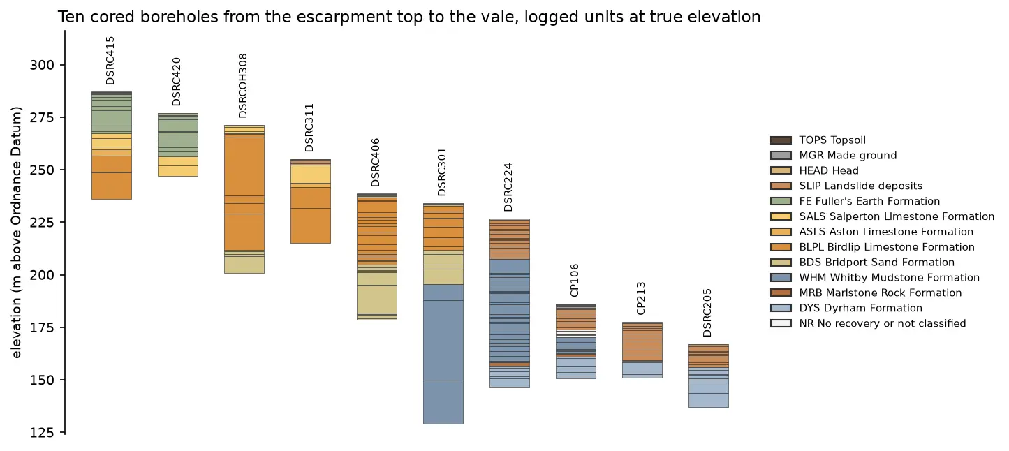
Read and validate AGS4 ground investigation data with Python
Find a real ground investigation in the British Geological Survey's AGS archive, download it as AGS4, learn how the file is put together, read it into pandas with python-ags4, fix every error the AGS checker reports, and check that the borehole logs make geological sense. The example is the A417 Missing Link at Crickley Hill.