#Ground model

2 posts

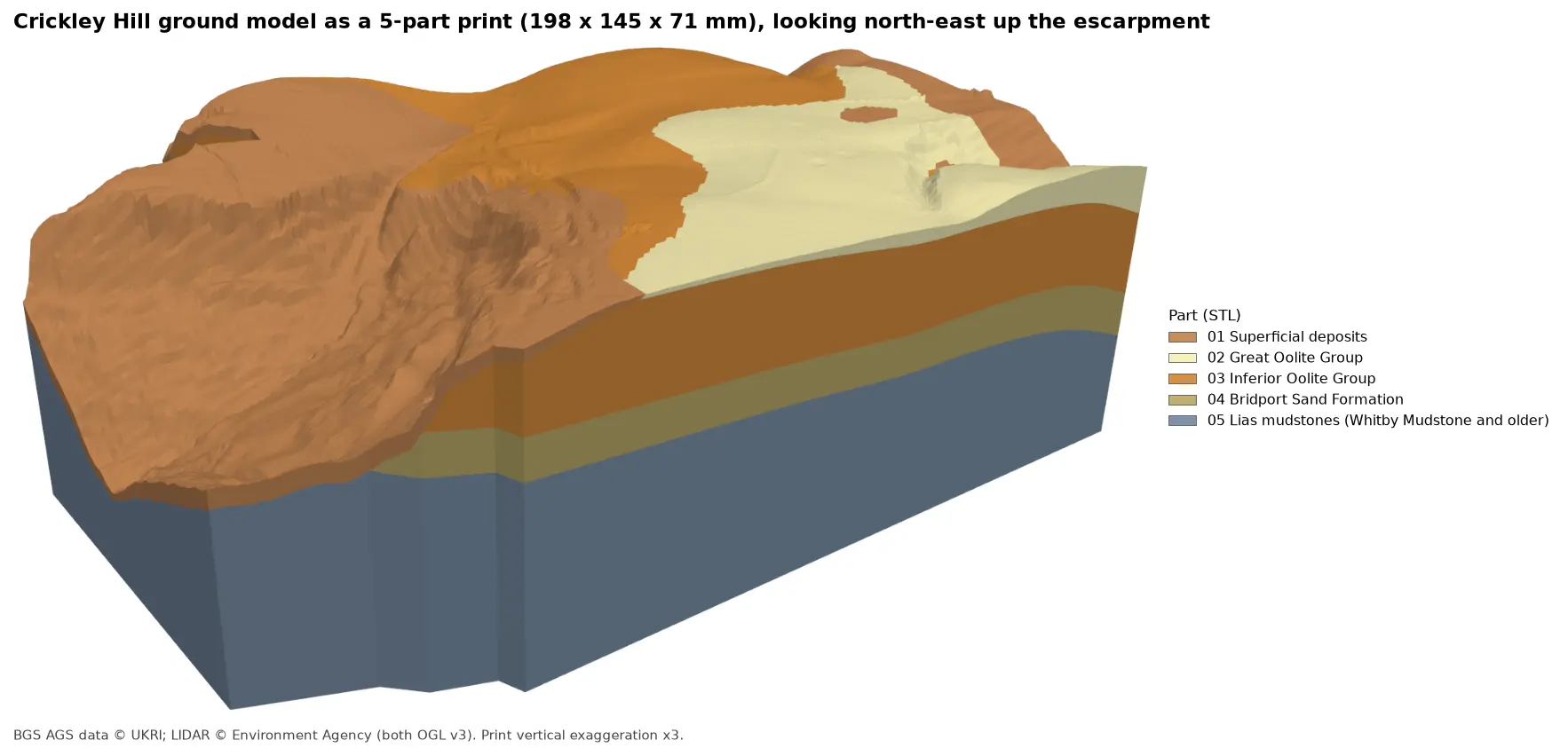
Rendered 3D print of the Crickley Hill ground model, 198 by 145 by 71 mm, looking north-east up the escarpment. Brown superficial deposits cover the western slope, orange Inferior Oolite forms the scarp and plateau, pale yellow Great Oolite caps the south-east, and the side walls show a band of olive Bridport Sand over blue-grey Lias mudstones.

Tutorial Python Part 7 of 7

3D-print a geological ground model: one watertight STL per stratum

Turn the kriged stratum surfaces from Part 5 into a multi-material 3D print of the Cotswold escarpment at Crickley Hill. Cut a window, decide what is too thin to print, build one solid per unit with mesh booleans, prove the parts fit exactly and are watertight, and write five STLs and a colour 3MF for AMS and MMU printers.
Advanced 11 min read

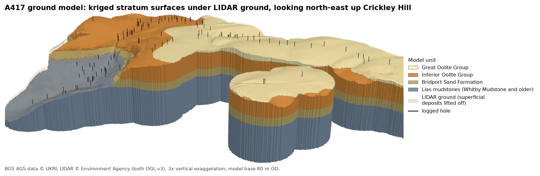
3D block model of the A417 ground model looking north-east up Crickley Hill: blue-grey Lias mudstones form the vale and the lower walls, under a band of olive Bridport Sand, a thick orange band of Inferior Oolite and pale yellow Great Oolite on the plateau. Black vertical lines mark the logged boreholes, and a faint buff skin shows the LIDAR ground lifted off the superficial deposits.

Tutorial Python Part 5 of 7

A 3D ground model from AGS4 boreholes: kriged stratum surfaces in Python

Pick rockhead and the top and base of the key formations from real AGS4 logs, krige them into stratum surfaces under Environment Agency LIDAR ground, and build a 3D ground model of the A417 escarpment in PyVista. Then test it: leave-one-out cross-validation at every borehole, kriging standard deviation maps, a check against every hole that stops short of a surface, and proof that no surface crosses another.

Advanced 15 min read